
According to storm news, the latest low pressure from the Philippine Atmospheric, Geophysical and Astronomical Services Administration (PAGASA), tropical storm Pilandok has slowed down as it moves over the Philippine Sea, but is still far from the mainland and is unlikely to make landfall in this country.
As of 8:00 AM on September 2nd (Philippines time), tropical storm Pilandok is still within the Philippine Area of Responsibility (PAR). Meanwhile, tropical storm Saudel and low pressure area LPA 08m are outside this area.
Typhoon Pilandok has changed its direction of movement. According to the 5 am bulletin, the typhoon is about 1,205km east-northeast of the northern tip of Luzon and is moving in a east-northeast direction at a speed of 10 km/h. PAGASA forecasts that the typhoon will then move to the northwest and continue to maintain tropical storm status.
Images updated at 8 am show Pilandok located about 1,250km east-northeast of Luzon's northernmost point and moving northwest at a speed of about 10 km/h.
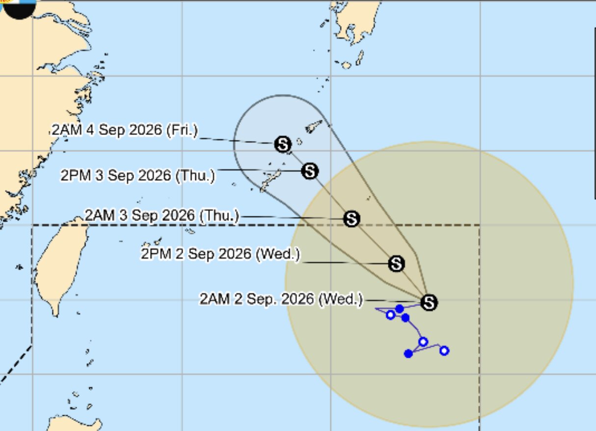
Pilandok is forecast to continue to maintain tropical storm level as it moves towards southern Japan.
However, the meteorological agency warns that some areas may still experience heavy rain and strong winds, even outside the area forecast to be the path of the storm.
Meanwhile, tropical storm Saudel is outside PAR.
In addition to the 2 storms, PAGASA is also monitoring the 08m low pressure area, located outside PAR. This low pressure area is about 2,870km east of central Luzon and is assessed to have a low possibility of developing into a tropical depression in the next 24 hours.
PAGASA recommends that people continue to follow official updates on the developments of these weather systems.


