Not yet able to recover from floods caused by storm No. 5 Kajiki, Central Vietnam is facing a new danger named storm No. 6 Nongfa. Although it is forecast to weaken rapidly after making landfall, this storm still has the potential to cause heavy rain, lasting for many days and increasing flooding.
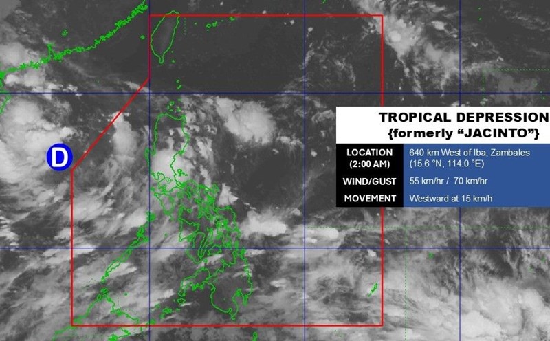
According to the US Joint Typhoon Warning Center, tropical depression 20W has strengthened into tropical storm Nongfa, officially becoming the sixth storm of 2025 in the East Sea.
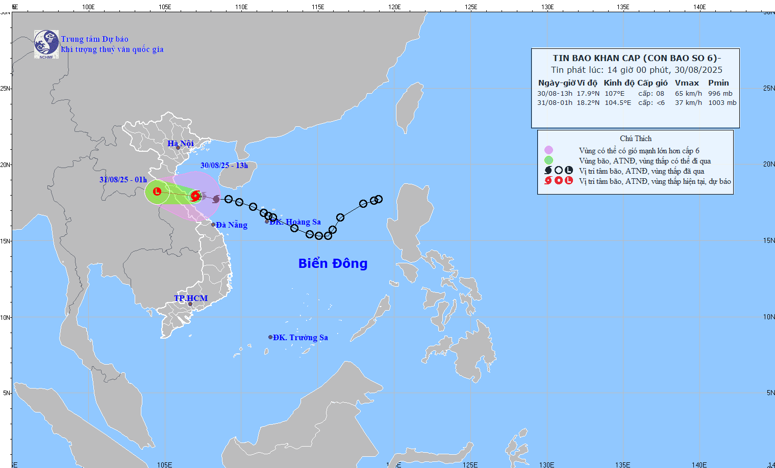
At 1:00 p.m. on August 30, the center of the storm was at 17.9 degrees North latitude, 107.0 degrees East longitude (off the coast of Ha Tinh - Quang Tri). The strongest wind is level 8 (62-74 km/h), gusting to level 10-11. The storm is moving westward at a speed of 20-25 km/h. The provinces from Nghe An to Da Nang have had heavy rain, some places have had very heavy rain over 200mm.
Storm forecast models show Nongfa is unlikely to intensify as its structure is still cross-cocked with winds, but the abundant moisture could cause widespread heavy rains.
The most worrying point is not the wind power, but the amount of rain Nongfa brings. It is forecasted that from now until the end of the weekend, many Central provinces, especially from Thanh Hoa - Quang Tri, will experience more heavy to very heavy rains.
The areas that have just been affected by storm No. 5 Kajiki are still flooded and landslides, and now continue to face the risk of overlapping floods, threatening people's lives and property. Landslides in mountainous areas and flash floods in small rivers and streams may occur unexpectedly.
International typhoon forecasters agree that Typhoon Nongfa will weaken rapidly after making landfall, gradually dissipating into a tropical depression within 18 hours. However, the storm's huge amount of moisture will continue to cover Vietnam and Laos, causing persistent rain for many days.
This means that the consequences are not the direct destructive power of storms and winds, but the floods after storms.
According to the latest storm information from the Vietnam National Center for Hydro-Meteorological Forecasting, it is forecasted that by 1:00 a.m. on August 31, the storm will move in a West-Northwest direction, at a speed of 20 km/h, into the mainland of Ha Tinh - North Quang Tri, weakening into a tropical depression, then into a low pressure area.

Location: 18.2 degrees North latitude, 104.5 degrees East longitude (Central Laos). Intensity below level 6.
Dangerous area: 16.5 degrees North latitude, 20.0 degrees East longitude, West 110.0 degrees East longitude.
Natural disaster risk level: Level 3, Thanh Hoa - Quang Tri sea area (including Hon Ngu, Con Co).
At sea: Thanh Hoa - Quang Tri (hon Ngu, Con Co) has winds of level 6-7, near the center of the storm level 8, gusts; waves 2.0-4.0m, near the center of the storm 3.0-5.0m, rough seas. The Gulf of Tonkin has winds of level 6-7, gusts of level 9; waves of 2.0-4.0m.
Rising water: Nghe An coastal area - Hue city is 0.2-0.4m high.
On land: Nghe An - Quang Tri wind level 6, gusting 8; Ha Tinh - Bac Quang Tri level 6-7, near the storm center level 8, gusting 10.
Forecast of heavy rain: Afternoon of August 30 to the end of August 31: Thanh Hoa - Quang Tri heavy to very heavy rain, 100-220mm, some places over 400mm. In the midlands and Northern Delta, there will be 50-120mm of rain, some places over 250mm.


