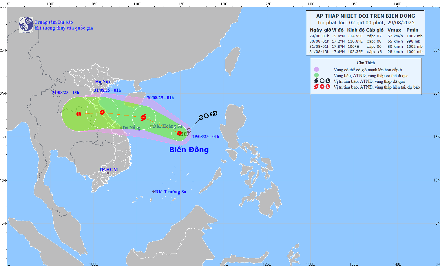
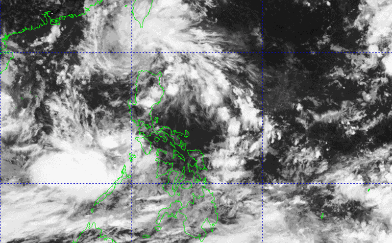
The updated storm forecast at 3:00 a.m. on August 29 of the Philippine Atmospheric, Geophysical and Astronomical Services Administration (PAGASA) said that tropical depression Jacinto has left the Philippines, currently at 15.7 degrees North latitude, 113.9 degrees East longitude, 650km west of Iba, Zambales. Maximum wind speed is 55 km/h, gusting to 70 km/h, moving west, traveling 15 km/h.
This is the 10th tropical depression to enter the Philippines' affected area this year, intensifying the southwest monsoon, affecting domestic weather conditions, and causing heavy rain.
In previous storm bulletins, forecasters have noted that the tropical depression is heading towards the North or Central region of Vietnam, expected to make landfall in the afternoon or evening of Saturday (August 30). The tropical depression is expected to strengthen into storm No. 6 in the East Sea on the evening of August 29.
According to the Vietnam National Center for Hydro-Meteorological Forecasting, at 1:00 a.m. on August 29, the tropical depression was about 320km East Southeast of Hoang Sa Special Zone. The strongest wind near the center of the tropical depression is level 6-7 (39-61 km/h), gusting to level 9. Moving west at a speed of 10 km/h.
It is forecasted that by 1:00 a.m. on August 30, the center of the tropical depression will be at 17.2 degrees North latitude, 110.8 degrees East longitude; in the northwest sea of the Hoang Sa special zone. Intensity level 8, gust level 10. Moving west-northwest, about 20 km/h. The North East Sea area (including Hoang Sa special zone), the North Central East Sea area, and the offshore waters from Nghe An to Hue City are at risk of level 3 natural disasters.
It is forecasted that by 1:00 a.m. on August 31, the center of the tropical depression/or storm will be at 17.8 degrees North latitude, 106.0 degrees East longitude; on land from Nghe An to Hue City. Intensity level 6, gust level 8. Moving west-northwest, about 20-25 km/h. The sea area west of the North East Sea (including Hoang Sa special zone), the sea area from Nghe An to Hue City is at risk of level 3 natural disasters.

Regarding heavy rain forecast: In the evening and night of August 29, rain will appear in coastal areas and mainland coastal provinces from Quang Ninh to Thanh Hoa. Heavy rain in Quang Ninh due to a large cloud of moisture moving from the Loi Chau area, independent of the offshore tropical depression. The estimated rainfall is about 50-70mm, locally up to 150mm.
Forecast on August 30, heavy rain in the provinces from Quang Tri to Nghe An, areas with heavy rain with high intensity may be in Ha Tinh and Nghe An. Rainfall may range from 100-150mm, with some rainfall over 150mm.
On August 31, the center of the rain will gradually narrow over Ha Tinh and Nghe An, especially the West of Nghe An. Heavy rain also moved to the West of Thanh Hoa, Hoa Binh, Hanoi, Ha Nam, Son La and the Northwestern midland provinces.
According to the forecast, if the tropical depression strengthens into storm No. 6, it will not be strong when it is close to the shore because the sea surface near the shore will cool down due to the prolonged rain from storm No. 5.


