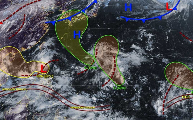
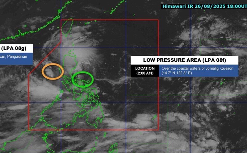
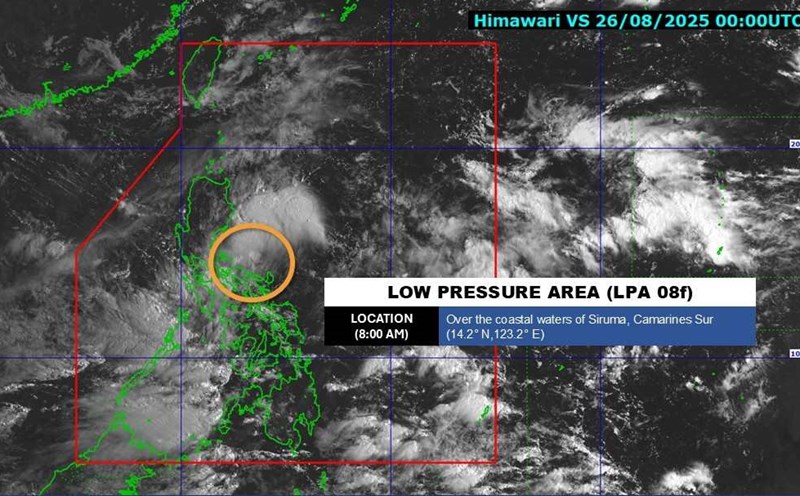
The latest storm and low pressure information from the Philippine Atmospheric, Geophysical and Astronomical Services Administration (PAGASA) said that the new low pressure at 08:00 was detected outside the Philippine Forecast Area (PAR) on August 29.
The low pressure is about 1,52 km east of northeast Mindanao, Philippines as of 2:00 a.m. on August 30.
Previously, when detected at 3:00 p.m. on August 29, the low pressure near the South China Sea was 1,410 km east of southeast Mindanao.
Philippine weather forecasters said that the 08:00 low pressure is unlikely to develop into a tropical depression in the next 24 hours.
PAGASA weather expert Benison Estareja noted that 08:00 seems unlikely to develop into a tropical depression in the next 3 days, but it could enter PAR on August 30.
Currently, the low pressure near the East Sea at 08:00 does not affect any area of the Philippines. The southwest monsoon is still the main weather system across the Philippines.
The southwest monsoon is expected to continue to bring scattered showers and thunderstorms to Mimaropa, Cavite, Batangas, Visayas and Mindanao, as well as scattered showers or thunderstorms to the rest of Luzon.
Flash floods and landslides can occur during moderate to heavy rains or severe thunderstorms.
PAGASA added that the trough or extension of Typhoon Jacinto - a system in the East Sea that the Philippines assessed as having strengthened from a tropical depression to a tropical storm since the morning of August 29 is still causing rain in the country.
Ilocos, Batanes, Babuyan Islands, Zambales and Bataan are experiencing scattered showers and thunderstorms from the Jacinto trough, while the Cordillera administrative region, the rest of Cagayan Valley and other parts of Central Luzon will experience scattered showers or thunderstorms.
Jacinto left PAR at 5:00 p.m. on August 28, just nine hours after forming in the South China Sea.
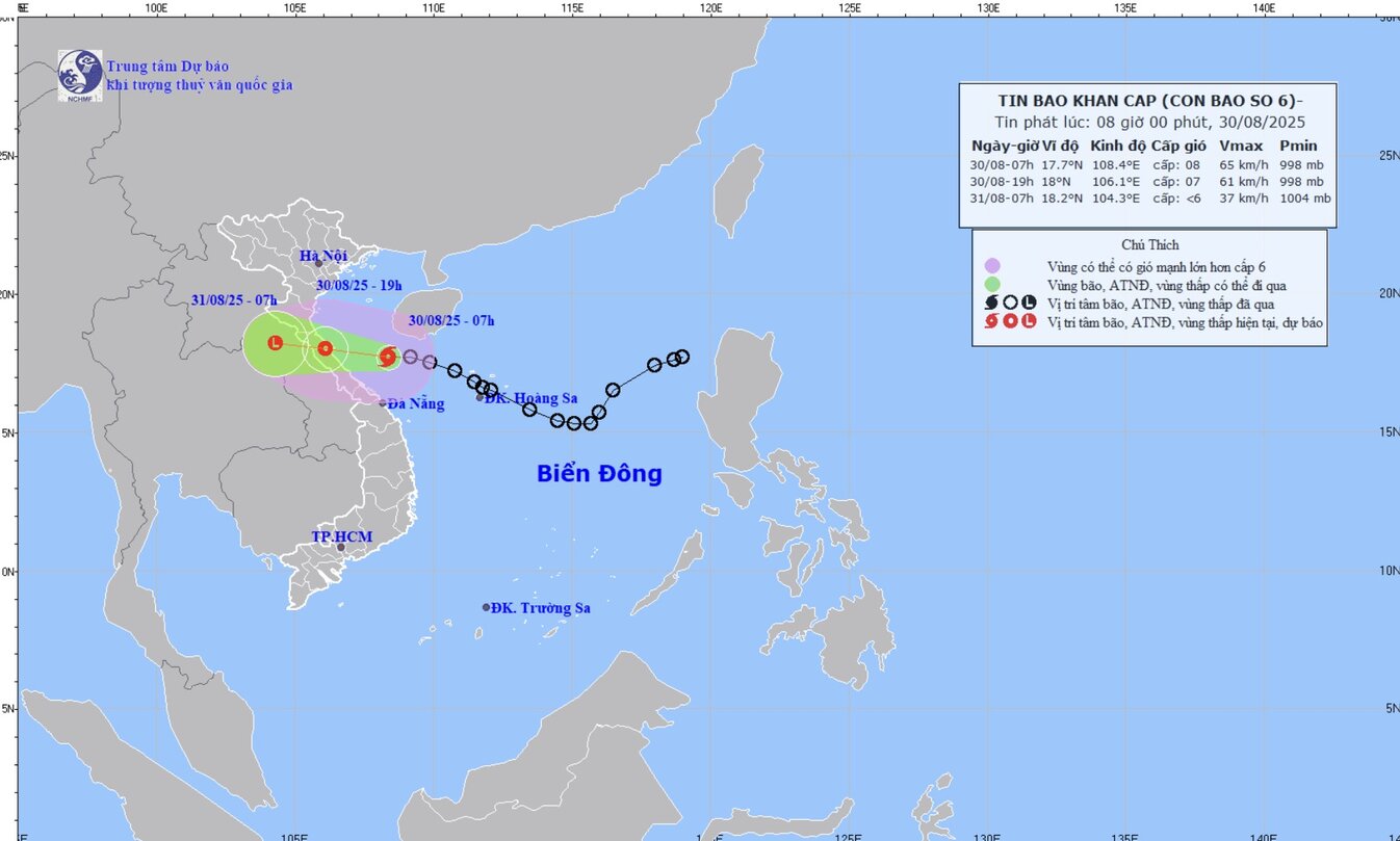
Meanwhile, the latest storm information from the US Navy's Joint Typhoon Warning Center (JTWC) said that the system in the East Sea, called Jacinto by the Philippines and 20W by the JTWC, is a tropical depression.
This tropical depression in the East Sea is 180km northeast of Da Nang and has been moving west-northwest at a speed of 37 km/h in the past 6 hours.
The tropical depression is forecast to maintain a speed of 20-35 km/h in a stable direction, making landfall just north of Dong Hoi on the evening of August 30.
JTWC forecasters warn that the tropical depression will see stronger winds right before making landfall.
The storm structure shows that the heaviest rainfall and convective hazards will appear between the low pressure system and Hue city.
When it makes landfall, the tropical depression will weaken rapidly and likely have no trace left when passing through Laos.
Emergency storm news, storm No. 6 at 8:00 a.m. on August 30 of the Vietnam National Center for Hydro-Meteorological Forecasting, on the morning of August 30, the tropical depression in the northwest sea of the northern East Sea strengthened into a storm - storm No. 6 (international name Nongfa).
At 7:00 a.m. on August 30, the center was at 17.7 degrees north latitude - 108 degrees east longitude, in the Ha Tinh sea area - Hue City. Storm No. 6 Nongfa is about 210km east of northern Quang Tri. Maximum wind speed: Level 8 (62-74 km/h), gust level 10. Moving west-northwest, speed 20 km/h.

