China has activated a level IV emergency response as Typhoon No. 7 Tapah approaches Guangdong province, bringing heavy rain and strong winds.
The country's emergency management agency said working groups had been sent to Guangdong to provide response, while Hong Kong (China) also issued a warning signal for Typhoon Tapah.
Tapah is the 16th storm to hit the Northwest Pacific this year, with landfall on the night of September 7 or early morning of September 8.
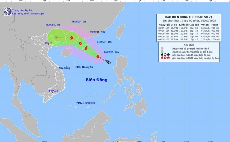
In the East Sea, according to the Vietnam National Center for Hydro-Meteorological Forecasting, at 4:00 a.m. on September 7, the center of storm No. 7 Tapah was at about 18.9 degrees North latitude, 114.8 degrees East longitude, right in the northern sea of the East Sea.
The wind near the storm center is strong at level 8-9 (62-88km/h), gusting to level 11, moving in the West Northwest direction at a speed of about 10km/h.
It is forecasted that by 4:00 a.m. on September 8, the storm may reach level 10 intensity, gusting to level 13, when approaching the sea area south of Quang Dong.
By 4:00 a.m. on September 9, after moving deep into mainland China, the storm will gradually weaken and dissipate over the Guangxi area.
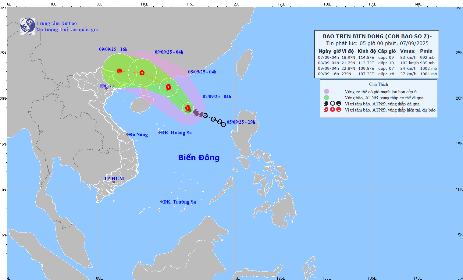
Due to the influence of storm No. 7 Tapah, the North East Sea will have strong winds of level 7-8, near the storm's eye level 9-10, gusting to level 13. Waves 3-5m high, rough seas, endangering ships operating in the area. The Center for Hydro-Meteorological Forecasting warns of natural disaster risks in the North East Sea at level 3.
Meanwhile, the Philippines is also indirectly affected by the circulation of storms and the southwest monsoon. Ilocos, Zambales, Bataan regions will have scattered thunderstorms, with the risk of flash floods and landslides; Metro Manila and many other areas may have local thunderstorms.
For Vietnam, although not located on the direct path of Typhoon Tapah, the development of the southwest monsoon combined with the storm will make the weather in the North East Sea dangerous, requiring ships to pay special attention to stay away from the danger zone.
In addition, after the storm moves deep into the mainland of Guangdong province (China), gradually weakens and moves westward, remnants shift to the northern mountainous provinces of Vietnam, possibly causing a widespread heavy rain in the northern provinces, focusing on the mountainous and midland areas of the northern provinces from September 9-11.
It is forecasted that heavy rain in a short period of time can lead to the risk of flash floods and landslides, especially in areas with narrow riverbeds and streams, with large slopes, at the foot of hillsides and low-lying areas along the river.