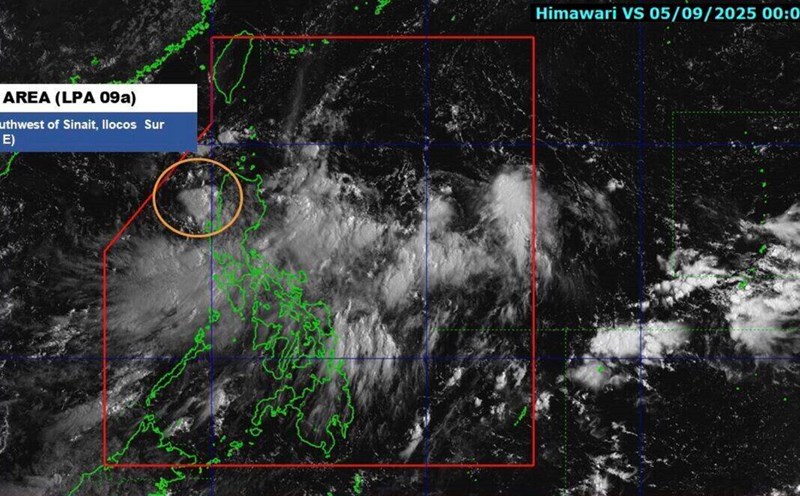
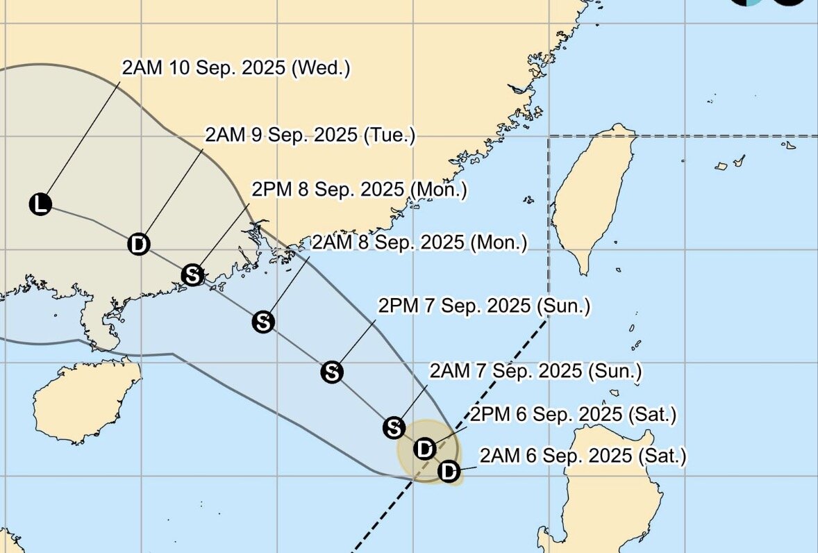
The latest storm information from the Philippine Atmospheric, Geophysical and Astronomical Services Administration (PAGASA) on the morning of September 6 said that the low pressure in northwest Luzon, Philippines has strengthened into tropical depression Lannie.
The bulletin said that the center of the latest tropical depression in the East Sea is 315km west of Sinait, Ilocos Sur.
Maximum sustained winds near the center of Lannie are 45 km/h, gusting up to 55 km/h.
Lannie is moving west at a speed of 15 km/h, with strong winds extending up to 150 km from the center of the depression.
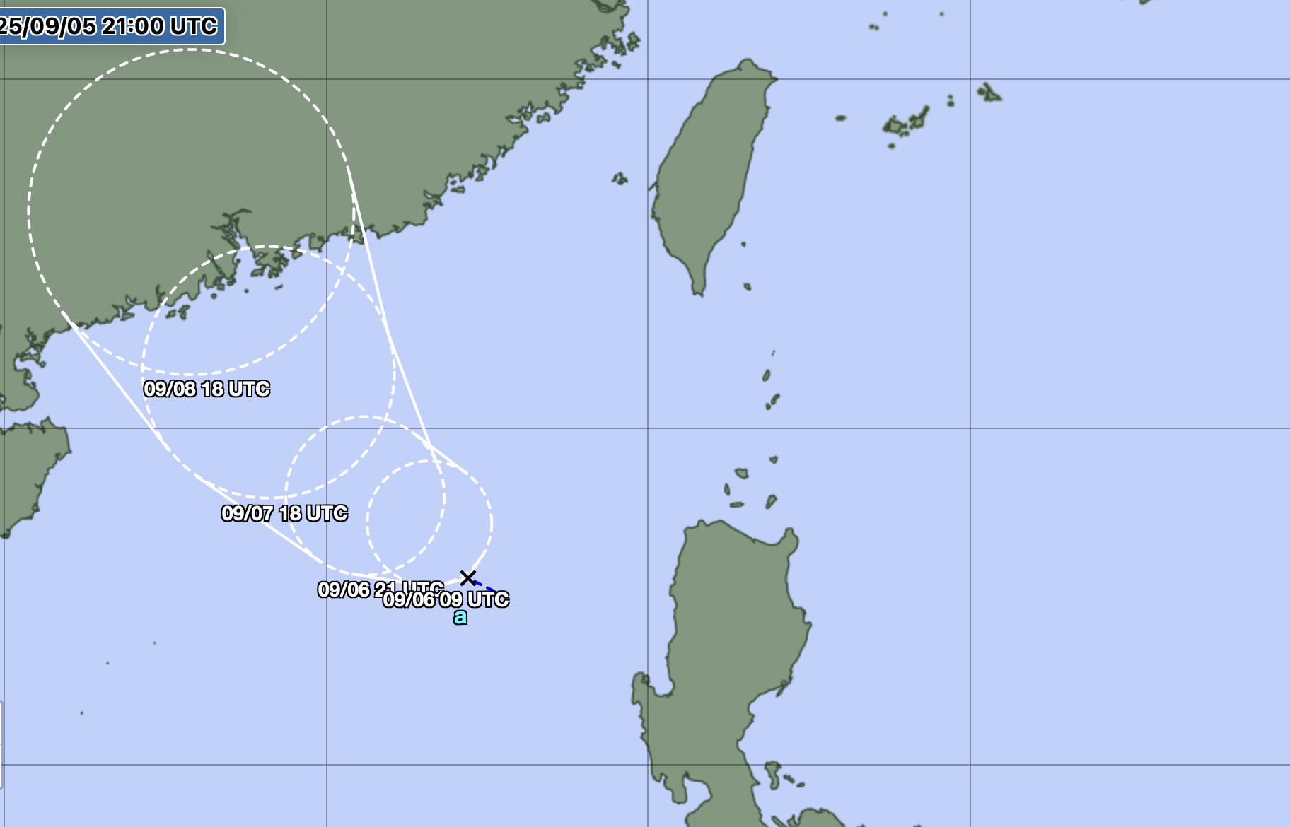
Philippine typhoon forecasters said Tropical Depression Lannie is expected to move northwest until September 8, then turn west-northwest for the remainder of the forecast period.
According to the forecast track, the tropical depression in the East Sea will leave the Philippine Forecast Area (PAR) this morning or this afternoon (September 5).
Tropical depression Lannie is forecast to strengthen into storm No. 7 in the East Sea on the night of September 6 or the morning of September 7.
Lannie is a tropical depression or storm No. 12 that enters or forms in the Philippine Forecast Area this year.
This tropical depression in the East Sea is forecast to affect the weather in the Philippines, leading to cloudy skies, scattered rains and thunderstorms across Ilocos, Cordillera Administrative and Cagayan Valley.
The southwest monsoon will affect the urban areas of Manila, Central Luzon, Mimaropa and Calabarzon, while the rest of the Philippines will have local thunderstorms.
In particular, the western part of Northern Luzon is expected to have moderate to strong winds and moderate to severe waves due to the influence of the tropical depression.
The tropical depression in the East Sea is also being monitored by the Japan Meteorological Agency. However, weather forecasters in Japan said that this tropical depression is expected to strengthen into a tropical storm from September 8.
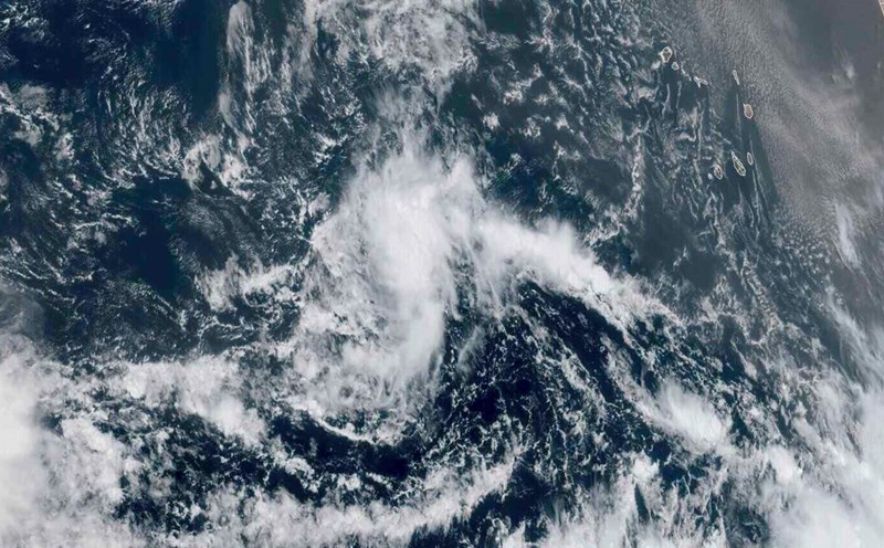
The US Navy's Joint Typhoon Warning Center (JTWC) is also monitoring the tropical depression in the East Sea Lannie and has named it Invest 97W.
JTWC forecasters said that the tropical depression located in northwest Luzon, Philippines is likely to strengthen into a storm in the next 24 hours. The system currently has maximum sustained winds of about 30-35 km/h. Analysis shows that this area currently has a favorable environment for the development of low pressure, with low wind shear, hot sea surface temperatures (about 30 degrees Celsius).
Forecasters all believe that Typhoon No. 7 in the East Sea will move northwest towards mainland China and continue to strengthen in the next 24 hours.