On September 4, the Philippine Atmospheric, Geophysical and Astronomical Services Administration (PAGASA) announced a storm/low pressure forecast for the first two weeks of September, with the possibility of affecting the East Sea.
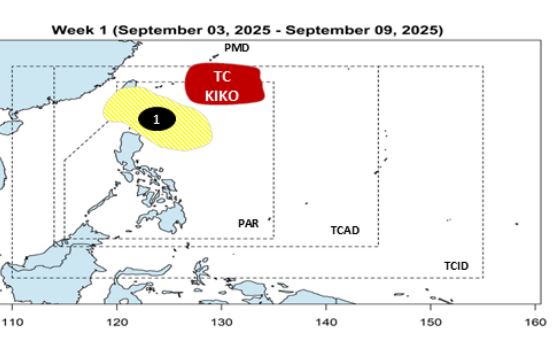
During the week of September 3-9, 2025, PAGASA said Amor Amorphoon had formed northeast of the Philippine Forecast Area (PAR) but did not directly impact the country. Typhoon Kiko is moving north, heading south of Japan.
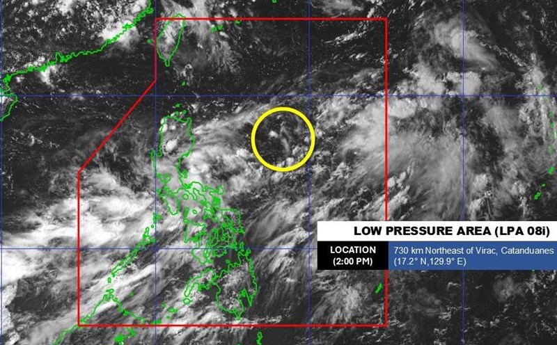
However, a new low pressure (low pressure 1) is likely to appear near the northeast of Luzon this week. This system has a low probability of developing into a typhoon, but is likely to head towards Taiwan (China).
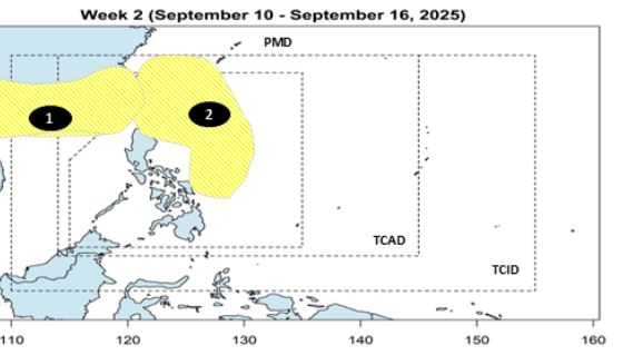
During the week of September 10-16, 2025, low pressure 1 will continue to move westward and out of the PAR, towards the East Sea, with a low chance of becoming a storm.
At the same time, another low pressure area (low pressure area 2) may form in the Philippine Sea, but the prospect of developing into a tropical depression or storm during this period is also not high.
PAGASA said the risk of tropical cyclone formation in the first half of September is present, especially in the week of September 3-9. The meteorological agency will continue to closely monitor all changes in the forecast model and update when necessary.
PAGASA forecasts that from now until the end of September, there may be 2 to 4 storms, most of which are likely to enter the East Sea. The resonance impact of the La Nina phenomenon has caused the risk of floods and landslides in the area to increase significantly.