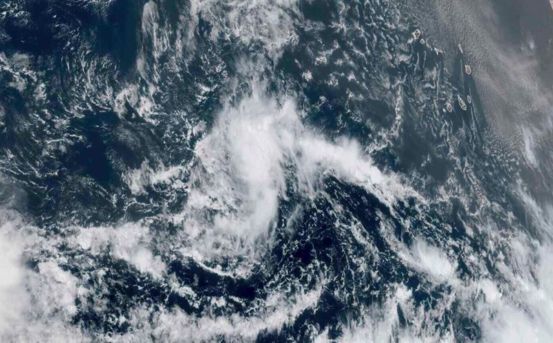
The latest storm and low pressure information on September 5 from the Philippine Atmospheric, Geophysical and Astronomical Services Administration (PAGASA) said that at 8:00 a.m. the same day, the cloud cluster west of Northern Luzon, Philippines became low pressure 09a. The low pressure in the East Sea has just formed and is being monitored in the Philippine Forecast Area (PAR).
Philippine weather forecasters say that low pressure 09a has a moderate chance of strengthening into a tropical depression in the next 24 hours.
The low pressure in the East Sea 09a is also being monitored by the Joint Typhoon Warning Center (JTWC) of the US Navy and is named Invest 97W.
The JTWC bulletin said that low pressure Invest 97W is located in the northwest of Luzon, Philippines. It is forecast that this low pressure is unlikely to strengthen into a tropical depression or tropical storm in the next 24 hours.
Currently, the low pressure in the East Sea is having maximum sustained winds of about 25-35 km/h.
JTWC forecasters found that conditions in the East Sea are favorable for this low pressure to strengthen, with strong wind shear from 30-35 km/h, warm sea surface temperatures, from 29-30 degrees Celsius.
Forecast models predict that 97 InvestW will develop and move southwest of Taiwan (China).
According to PAGASA's typhoon forecasters, the Philippines is expected to record up to four typhoons forming this September. Accordingly, there is a possibility of 2 to 4 storms entering or forming within the PAR forecast area.
Based on the forecast track, the September typhoon could pass north or south of Luzon, or could move north and further toward Taiwan (China) or southern Japan.
Previously, in August, five storms or tropical depressions formed in the Philippines, including: Tropical Depression Fabian, Typhoon Gorio (Podul), Tropical Depression Huaning, Tropical Typhoon Isang (later strengthened into Typhoon Kajiki) and Tropical Depression Jacinto (later Typhoon No. 6 Nongfa in the East Sea). This figure is higher than PAGASA's forecast of four storms or tropical depressions forming in August.
In addition to the newly emerged low pressure in the East Sea, the western Pacific basin is recording tropical storm Peipah, which originated from a low pressure in the eastern Philippines.
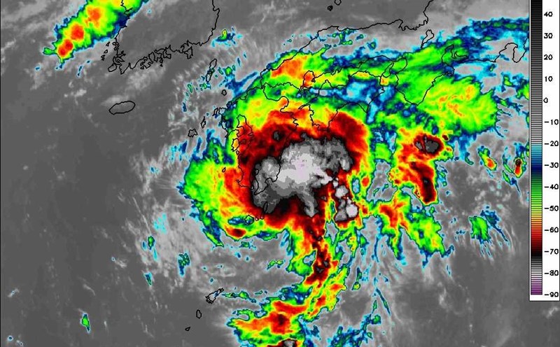
Typhoon Peipah made landfall in Kochi Prefecture, western Japan at around 1 a.m. on September 5. The storm made landfall in the area around Sukumo city and could bring heavy rains with the risk of flooding and landslides.
Typhoon Peipah is forecast to move east along Japan's Pacific coast. The storm could bring more than 50 mm/h of rain to the roads and surrounding areas.
Japan's weather forecasters said that rainfall in the 24 hours as of late as September 5 could reach 250mm in the central Tokai area and 200mm in the western Kinki area and the eastern Kanto - Koshin area.