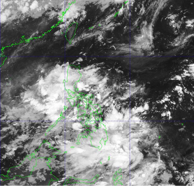
The latest storm information from the Philippine Atmospheric, Geophysical and Astronomical Services Administration (PAGASA) said that the tropical depression outside the Philippine Forecast Area (PAR) is very likely to develop into a storm in the next 24 hours, although it does not directly threaten the mainland.
At 3:00 a.m. on June 23, the center of the tropical depression was at about 23.9 degrees north latitude, 145.2 degrees east longitude, about 2,495 km east-northeast of the northernmost tip of Luzon Island. The tropical depression is moving northwest at a speed of 20 km/h, carrying maximum sustained winds of 55 km/h and gusts of up to 70 km/h.
However, PAGASA affirmed that the tropical depression has not directly affected any area of the Philippines and is unlikely to enter the PAR.
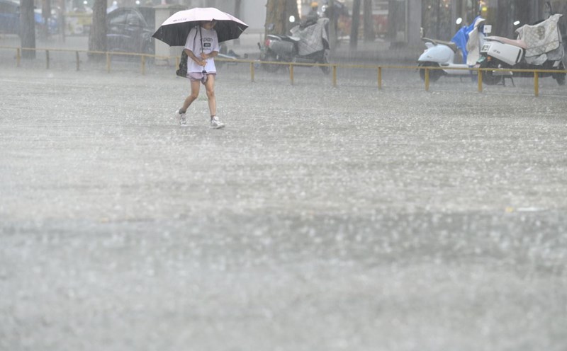
Although not affected by the tropical depression, the weather in much of the Philippines is still affected by the southwest monsoon, causing scattered showers and thunderstorms.
Areas including Metro Manila, Calabarzon, Barmm, Soccsksargen, Davao Region, Pangasinan, Zambales, Bataan, Occidental Mindoro and Palawan will experience cloudy skies with scattered showers and thunderstorms, with the potential for flash floods or landslides, especially in mountainous areas or steep terrain.
The remaining areas across the country will have little to no clouds, with possible scattered showers or thunderstorms. Strong thunderstorms can bring tornadoes, gusts of wind and localized flooding.
PAGASA recommends that people continue to monitor updated weather forecasts to proactively prevent risks caused by heavy rain or thunderstorms, especially in low-lying areas or areas prone to landslides.
For its part, the Vietnam National Center for Hydro-Meteorological Forecasting said that on the morning of June 23, showers and thunderstorms occurred in the areas: Northeast of the East Sea; Central and South East Sea (including the sea area of Truong Sa archipelago), From Binh Thuan to Ca Mau, Ca Mau to Kien Giang and the Gulf of Thailand.
It is forecasted that during the day and night of June 23, the above areas will continue to have showers and thunderstorms.
During thunderstorms, there is a possibility of tornadoes, strong gusts of wind of level 6-7, waves over 2m high.
The sea area from Binh Thuan to Ca Mau has strong southwest winds of level 5, sometimes level 6, gusting to level 7, causing rough seas.
Regarding rain forecast, day and night of September 23: The mountainous and midland areas of the North will have rain, moderate rain, scattered thunderstorms, locally heavy to very heavy rain. The common rainfall is 20-40mm, in some places over 100mm. The rain will be concentrated in the late afternoon and night.
The Central Highlands and the South will have scattered showers and thunderstorms, locally heavy rain (10-30mm), some places over 60mm. Rain will be concentrated in the late afternoon and evening.
The Vietnam National Center for Hydro-Meteorological Forecasting also issued flood warnings on the Cau River and Thuong River. On June 23, floods downstream of Cau and Thuong rivers will continue to rise and will be at alert level 1, alert level 2, then gradually decrease.
There is a high risk of flooding in low-lying areas along rivers, flash floods and landslides on steep slopes in the mountainous areas of the North.