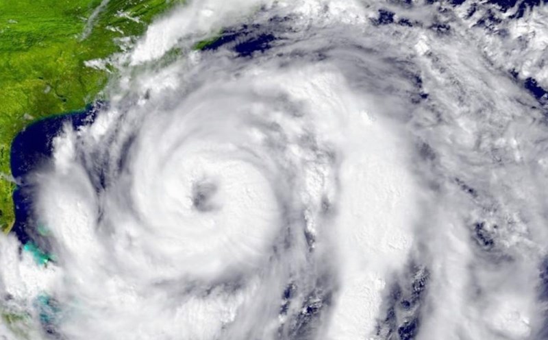
Although the 2025 Atlantic hurricane season has not officially began until June 1, meteorologists are monitoring a large area of low pressure forming near Central America - which could become the "cradle" of the first storm in 2025, earlier than expected.
According to the FOX Weather Forecast Center, meteorological forecast models show a high probability of a wide low pressure area developing over the weekend, stretching from the Pacific Ocean through Central America to Colombia.
This phenomenon may be related to a large-scale atmospheric cyclone called Central American Gyre - the "guest" behind many unseasonal storms in the past.
Bryan Norcross, a hurricane expert for FOX Weather, said: This Central American depression will cause prolonged rain in the region, but the high pressure in the northern Caribbean will prevent it from moving north.
However, in some favorable conditions such as warm enough sea temperatures and weak upper-level winds, tropical cyclones may form within this low pressure area.
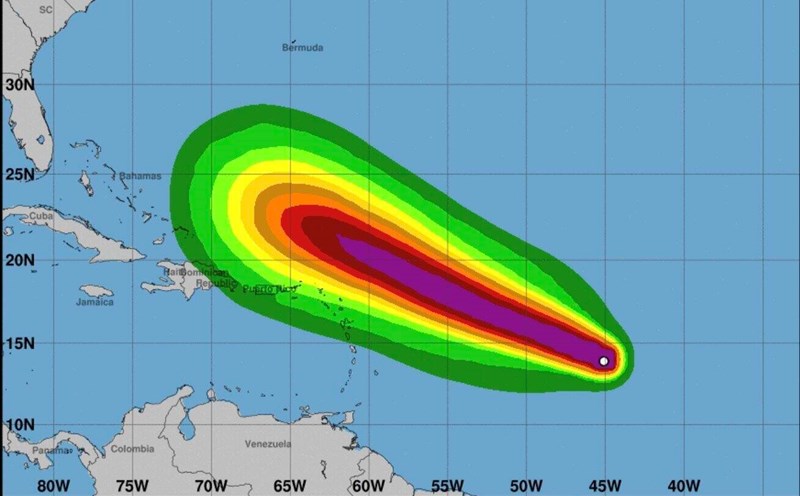
Central American Gyre is not a typhoon, but it is like a "raindrop", sucking moisture from the Pacific Ocean and spreading out hundreds of kilometers. The consequences are often heavy rains, flooding and landslides, affecting more than a dozen countries from Guatemala to Colombia.
Unseasonal storms are no longer rare. According to historical data from the US National Oceanic and Atmospheric Administration (NOAA), since 1851, there have been 43 tropical cyclones forming in the Atlantic before June 1, an average of every four years.
Notably, in the 2015-2021 period, each year, at least one early-forming storm will be recorded. Only in the 2022 and 2024 storms will there be no unseasonal storms.
Initial forecasts suggest that the 2025 Atlantic hurricane season could continue to thrive. According to a report released on January 3 by Colorado State University (CSU), the region could see up to 17 named storms, of which 9 could strengthen into storms, and 4 reached " major hurricane" status (level 3 or higher, with winds of 179 km/h).
This figure is all above the average of the past 30 years, which was 14 named storms, 7 storms and 3 typhoons per season.
Regarding the storm season in the East Sea (from June to November), the Vietnam National Center for Hydro-Meteorological Forecasting said that the 2025 storm season is very complicated and unpredictable. There are many uncertain factors that dominate storm activity such as ENSO, monsoon season, inter-season fluctuations (MJO), operation of subtropical air systems, sea surface temperature...

With the current neutral ENSO state, the 2025 typhoon season in the East Sea and Northwest Pacific is likely to be approximately the average of many years in both quantity and intensity.
The first tropical storm or depression in the Northwest Pacific region usually appears in May or June. The possibility of storm formation right in the South China Sea in the beginning of the season (May-June) is lower than the storm from off the Philippines into the South China Sea.