On May 14, the Philippine Atmospheric, Geophysical and Astronomical Services Administration (PAGASA) released the latest forecast on the risk of tropical cyclone formation in the monitoring area.
Accordingly, during the week of May 14-20, 2025, the low pressure may appear near the Philippines, with the possibility of strengthening into a low storm.
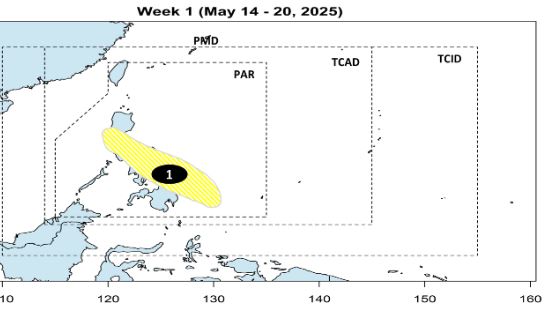
Typhoon forecast models show a weak low pressure area likely to form southeast of the Philippine Forecast Area (PAR), then move east of Mindanao, Visayas and Southern Luzon.
However, the possibility of the depression developing into a storm is low this week.
During the week of May 21-27, 2025, the low pressure is forecast to continue moving towards the West Philippine Sea (ie the East Sea). The possibility of storm formation this week is still assessed by PAGASA as low.
Based on current forecast models, there are no clear signs of storm formation in the East Sea and surrounding areas in the next 2 weeks.
However, PAGASA will continue to closely monitor weather developments, especially any changes related to convective cloud structure or the movement direction of the low pressure.