After a relatively calm and mild start to the week across much of the eastern United States, a complex storm system will form midweek, bringing a variety of extreme weather events.
The mix of warm, moist air and cold air from the Arctic will create dangerous weather for millions of Americans this week, AccuWeather storm/low pressure forecaster Brandon Buckingham said. Severe thunderstorms, dangerous ice storms and heavy snowfall are all expected to develop from Feb. 5-6 as the storm moves east.
Not one but two major winter storms will impact northern states this week and into the weekend, bringing significant amounts of freezing rain — a distinct feature from previous storms this winter. A third storm system could also form next week.
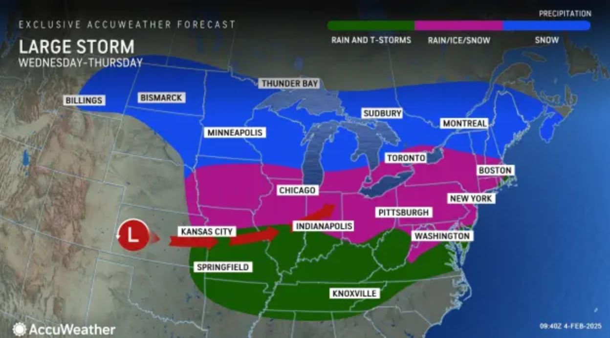
The first storm will bring ice and snow to millions of people across more than a dozen states in the Midwest and Northeast from February 5-6, while a second storm will hit the same region later in the week.
Unusually cold air from the storm could force schools to close and disrupt travel on major roads. Strong winds combined with ice buildup could snap tree limbs and down power lines, causing extended power outages in many areas. Flights could be delayed or canceled due to dangerous icy conditions.
The main cause of this severe weather is the jet stream - a belt of strong winds at high altitude that helps hurricanes move. The large temperature difference between North and South America will strengthen this jet stream, pushing storms faster and causing wider impacts.
The first storm formed in the Midwest on February 5, moving into the Ohio Valley, Great Lakes and Mid-Atlantic region by evening.
On February 6, the storm moved into the Northeast, bringing heavy snow and widespread freezing rain, affecting many states, including Missouri, Iowa, Illinois, Indiana, Wisconsin, Michigan, Ohio, West Virginia, Virginia, Maryland, Washington D.C., Pennsylvania, New Jersey, New York, Connecticut, Massachusetts, Rhode Island, Vermont, New Hampshire and Maine.
Parts of Pennsylvania have been placed under a winter storm warning, which warns that travel could become “nearly impossible.”
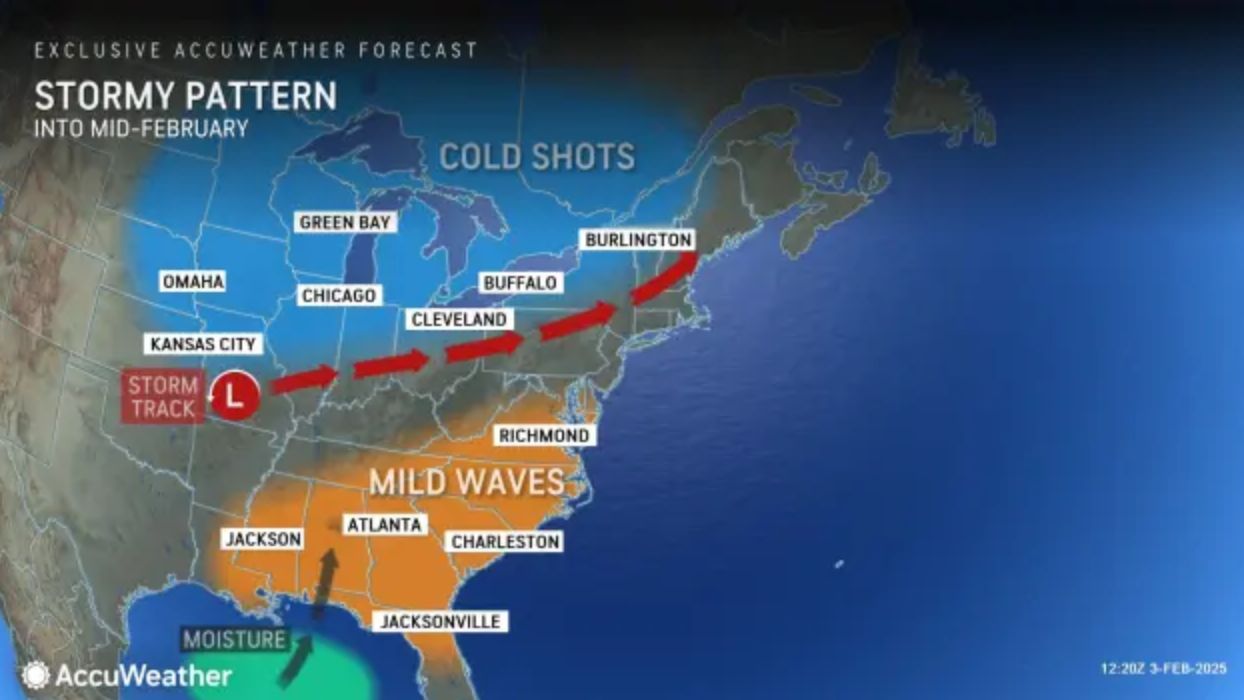
Weather forecasts show that when the storm reaches New England on February 6, temperatures will be cold enough for more snow to fall, affecting a series of cities such as Poughkeepsie, Albany (New York), Hartford (Connecticut), Providence (Rhode Island), Boston, Worcester (Massachusetts), Concord (New Hampshire).
Northern New York, Vermont, New Hampshire and Maine are expected to see the heaviest snowfall, between 7 and 15 centimeters.
By the morning of February 7, the storm will move into Canada, leaving cold weather and strong winds across the eastern United States.
Winter is still long and the US could continue to see more powerful snowstorms in the coming weeks.


