Low pressure is forecast to strengthen into a tropical depression tomorrow

Ngọc Vân |

Low pressure near the Philippines is forecast to strengthen into a tropical depression tomorrow (February 6).

The Joint Typhoon Warning Center (JTWC) forecast for February 5 said that a large weather disturbance area related to a long-standing low pressure area (Invest 92W) with a broad structure appeared southeast of Yap (Federated States of Micronesia) and Palau (850 km east of the Philippines from Palawan Island), with little significant change in organization.

Current environmental conditions are not particularly favorable for development, but are expected to become somewhat more favorable over the next few days. A tropical depression may form on February 6 as the system moves slowly and unsteadily west-northwestward.

The system is forecast to weaken into a trough by the weekend as it moves across Mindanao and the Central Visayas region of the Philippines. However, it could redevelop into a tropical depression as it moves back into the sea next week. The 7-day chance of it forming is 50%. The JTWC advises residents in the Philippines to monitor the system closely.

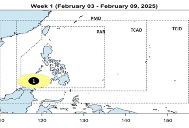
Previously, the storm and low pressure forecast on February 3 by the Philippine Atmospheric, Geophysical and Astronomical Services Administration (PAGASA) stated that during the week from February 3 to February 9, a new low pressure is expected to form near the Philippines.

A new low pressure system is likely to develop south of PAGASA's forecast area (PAR).

According to forecasters, this low pressure is located in the sea near the Philippines and is likely to enter the East Sea.

Du bao ap thap lien tiep xuat hien o Bien Dong trong nua dau thang 2. Anh: PAGASA
Low pressure is forecast to appear continuously in the East Sea in the first half of February. Photo: PAGASA

PAGASA forecasts that two to eight tropical storms may form within or enter PAR from January to June 2025.

February, March and April can have 1 storm each while May and June can have one or two disturbances.

On February 5, the JTWC also issued a strong wind warning in the Taiwan Strait (China), Luzon Strait and waters off northwestern Luzon due to strong northeast monsoon.

Strong winds also occurred in the waters around the Ryukyu Islands, including Okinawa (Japan). Along with that, a cold air mass extended from 30 degrees north latitude 122 degrees east longitude to 30 degrees north latitude 130 degrees east longitude, with a high pressure of 1028 hPa in China.

Cold air currents along the above coordinates are moving from China to the East Sea and the West Pacific.

The weather forecast bulletin of the Vietnam Center for Hydro-Meteorological Forecasting also said that on the day and night of February 6, the northeastern sea area of ​​the North East Sea and the sea area from Khanh Hoa to Binh Thuan will have strong northeast winds of level 6, gusting to level 7-8; rough seas; waves 2-4 m high. Natural disaster risk level due to strong winds at sea: level 2.

Ngọc Vân
RELATED NEWS

Forecast of 2 consecutive low pressure areas entering the East Sea

|

The latest storm and low pressure forecast said that in the first half of February, there will be 2 consecutive low pressure areas entering the East Sea.

Notable storm forecast near East Sea

|

The Philippine typhoon forecasting agency updated its latest forecast for typhoons in the first half of 2025.

First storm forecast near East Sea in February

|

The Philippine weather agency has issued a storm forecast for the first storm near the South China Sea in February 2025.

The US maintains a counterpart tax of 20%, opening up opportunities to reduce to 0% for Vietnamese goods

|

Maintaining the counterpart tax rate of 20% and the possibility of expanding the scope of tax reduction for some groups of goods to 0% will open up new opportunities for Vietnam.

Metro No. 1 reaches 14 million passengers, stops selling paper tickets at 11 stations

|

HCMC - From November 1, Metro Line 1 (Ben Thanh - Suoi Tien) will stop selling paper tickets at 5 more stations, bringing the total number of stations that have stopped selling tickets to 11/14.

Conflict of inexorable accounts over investment capital contribution of Hanoi University of Business and Technology

|

Not only in legal crisis, Hanoi University of Business and Technology was also accused of "abandoning" hundreds of investors, "losing" more than 117 billion VND in capital contributions.

sandbags are used all day and night to block the water of Tra Khuc river from overflowing into the inner city of Quang Ngai

|

Quang Ngai - The authorities are keeping their mouths closed day and night at the pumping station at the embankment project to prevent landslides on the southern bank, preventing the Tra Khuc River from flowing back into the inner city.

Floodwaters rise again, the center of Hue City becomes a chaotic traffic "river"

|

HUE - On the afternoon of October 29, floodwaters on rivers rose rapidly, causing many central streets of Hue City to be deeply flooded, vehicles stalled, and traffic paralyzed.

Forecast of 2 consecutive low pressure areas entering the East Sea

Thanh Hà |

The latest storm and low pressure forecast said that in the first half of February, there will be 2 consecutive low pressure areas entering the East Sea.

Notable storm forecast near East Sea

Khánh Minh |

The Philippine typhoon forecasting agency updated its latest forecast for typhoons in the first half of 2025.

First storm forecast near East Sea in February

Khánh Minh |

The Philippine weather agency has issued a storm forecast for the first storm near the South China Sea in February 2025.