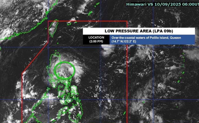
The latest storm and low pressure information from the Hong Kong Meteorological Station (China) said that there are expected to be 3 consecutive low pressure areas forming near the East Sea, causing rain and thunderstorms in the area.
Hong Kong (China) weather forecasters said that at least two of these depressions are likely to strengthen into storms.
In addition, low pressure troughs may lead to many unstable weather phenomena in the central and northern East Sea from early to mid-next week. "A low pressure area may form in a low pressure trough," the forecast stated.
"With the low pressure system moving north and getting closer to the southern coast of China by the end of next week, the weather will be unstable with more showers and thunderstorms across the region," forecasters in Hong Kong (China) noted.
A low pressure area is an area with lower atmospheric pressure than surrounding areas, often accompanied by bad weather, such as clouds, winds and possible rain or thunderstorms.
The weather bulletin of the Hong Kong Meteorological Station (China) also noted that a subtropical high pressure will continue to lead to very hot weather in Guangdong on September 14, while due to the influence of high-altitude air disturbances, showers and thunderstorms are expected early next week.
The hot weather affecting Hong Kong (China) will ease with increased rainfall next week, while low pressure systems around the East Sea will also be more active.
It is forecasted that the first low pressure near the East Sea will be relatively weak after entering the East Sea and will be very far from the coast of Guangdong province (China). However, the high-altitude air disturbances accompanied by this low pressure will cause showers and thunderstorms on September 15 and 16.
The second low pressure near the East Sea will move north towards China and approach the coast of Guangdong province in the middle and the end of next week, causing the weather in the region to become increasingly unstable with more showers.
These two depressions are forecast to strengthen into storms in the East Sea.
Meanwhile, the third low pressure is forecast to be stronger than the first two low pressure areas. This low pressure near the East Sea is forecast to approach Taiwan (China) and the Luzon Strait by the end of next week. Forecasters need more data to determine whether the third depression will strengthen into a storm or not. The possibility of this low pressure entering the East Sea is also uncertain.


