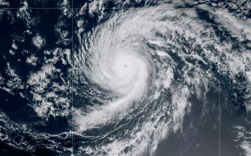
The latest hurricane report from the US National Hurricane Center said that Kiko will continue moving north of the Hawaiian Islands on September 10.
The typhoon has been downgraded to a tropical storm, with the center of the storm about 355km north of Hilo, Hawaii, and about 355km east-northeast of Honolulu.
Maximum sustained winds in Kiko are about 65 km/h. The storm is moving west-northwest at a speed of 23 km/h.
US weather forecasters say Kiko is creating large waves and dangerous offshore vents for many areas in Hawaii even as the system weakens. Waves will peak on September 10.
Kiko is forecast to only approach the northern part of the archipelago, not make landfall in the state, but experts advise Hawaii residents to monitor the storm's developments.
According to the latest storm news from AccuWeather, Amor is expected to cause heavy rain, big waves and even a risk of fire in Hawai. A big wave warning has been issued for the Big Island, Maui, Molokai starting on September 8 and for Oahu and Kauai starting on September 9.
AccuWeather forecasters say heavy rains from the impact of Kiko could bring 25-50mm of rain across the islands, with 50-100mm of rainfall east and north of the Big Island, Maui and Oahu.
"Trade winds may be interrupted as Kiko passes north of Hawaii. This could lead to local fire risk, especially in areas facing drought on the windward sides of the islands, warned Alex Da silva, AccuWeathers top hurricane expert.
According to the Honolulu weather agency, Kiko will move northwestward in the second half of the week and weather conditions in the Hawaiian Islands are expected to remain within the fire-prone danger threshold.
Meanwhile, the US National Hurricane Center said that the new low pressure Invest 95E has just formed and is active in southern Mexico.
The new low pressure is forecast to have a 40% chance of strengthening into a tropical depression or tropical storm in the next 2 days and an 80% chance of strengthening in the next 7 days.
Due to the influence of the new low pressure, heavy rain and thunderstorms have appeared in the southern and southwestern regions of Mexico.
Environmental conditions are favorable for the strengthening of Invest 95E, with a tropical depression likely to form later this week, moving west-northwest, almost parallel but off the coast of Mexico.