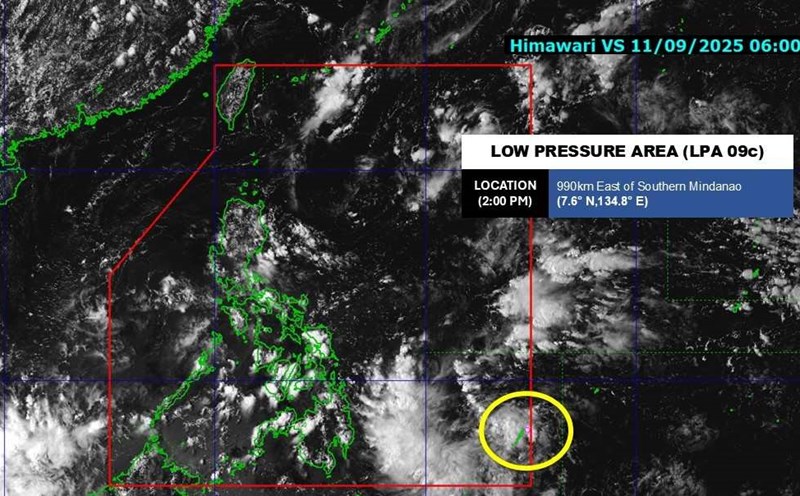
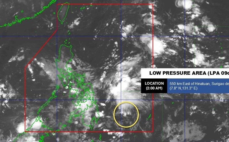
The Philippine Atmospheric, Geophysical and Astronomical Services Administration (PAGASA) said that at 3:00 a.m. on September 12, the center of low pressure 09c was at about 7.8 degrees north latitude, 131.3 degrees east longitude, about 540km east of Hinatuan City ( Surigao del Sur Province, Philippines).
PAGASA said that the possibility of strengthening into a tropical depression in the next 24 hours is assessed as low.
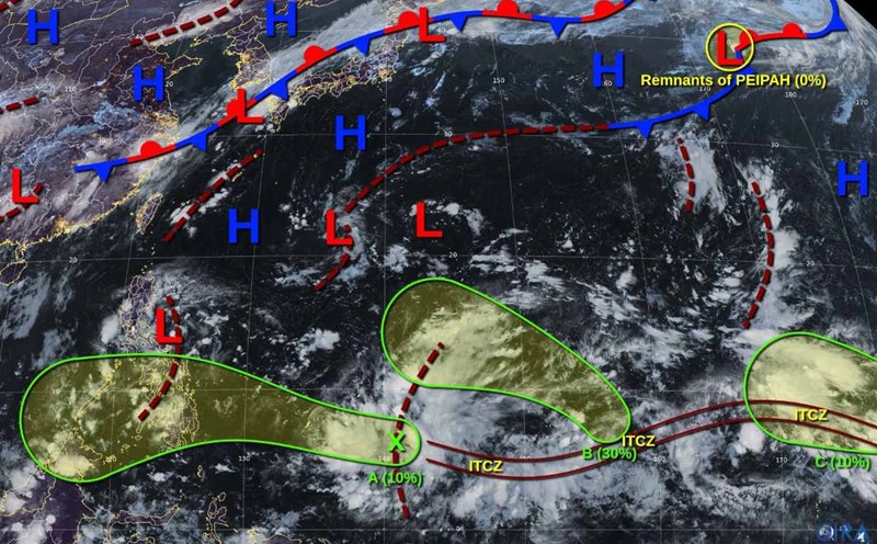
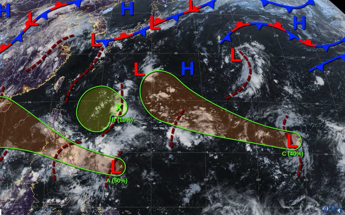
However, the Joint Typhoon Warning Center (JTWC) forecasts that as it moves west-northwest across the Philippines and turns out to sea, the low pressure (JTWC kyments as A) may gradually strengthen.
It is forecasted that from September 13 or September 14, the low pressure is likely to reach tropical depression level in the East Sea, with the probability of formation in the next 7 days at an average level - about 50%. The low pressure is forecast to affect Vietnam.
In addition, the JTWC also recorded some other disturbances in the Northwest Pacific region.
Interests B: The low pressure trough in Southeast Okinawa is causing scattered rain, but conditions are not favorable for development. The probability of formation in the next 7 days is only 10%.
Intermittent C: Northern weak low pressure area The Marshall Islands are expected to move west-northwest. From early next week, atmospheric conditions could improve, giving the system the potential to strengthen into a tropical depression when it approaches the Northern Mariana Islands. The probability of formation in the next 7 days is about 40%.
Storm forecasters say that if low pressure 09c strengthens in the East Sea, it will likely directly affect the weather in the coastal provinces of Central and Northern Vietnam in the coming days. People need to closely monitor the next weather forecasts to proactively respond.