Meteorological experts warn that the tropical areas in the East Sea, Atlantic and Pacific are experiencing many new disturbances/low pressure simultaneously, increasing the risk of storm formation in the second half of September.
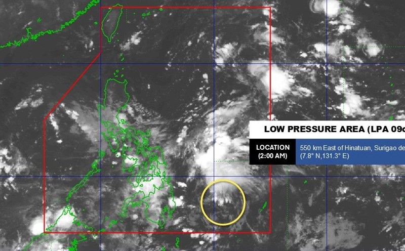
The Philippine Atmospheric, Geophysical and Astronomical Services Administration (PAGASA) forecasts that low pressure 09c is expected to pass through the central Philippines this weekend and will strengthen into a tropical depression or tropical storm, and will then be named Mirasol.
During the move, the system will bring widespread rain to Southern Luzon, Visayas and part of Mindanao for two days of September 13-14, with the risk of flooding and landslides. After that, Mirasol is likely to enter the East Sea, becoming a new monitoring focus in the area.
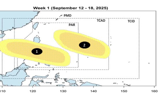
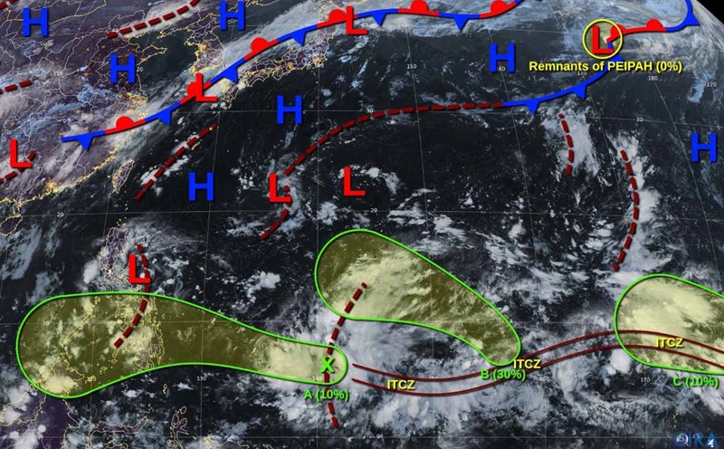
The Vietnam National Center for Hydro-Meteorological Forecasting said that in the last weeks of September, beware of the possibility of low pressure, tropical depressions and storms in the East Sea and off the Northwest Pacific.
Storms and tropical depressions are still active from now until December, mostly affecting the Central region. In December, it is necessary to be on guard against the possibility of making landfall in the Southern region.
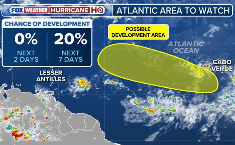
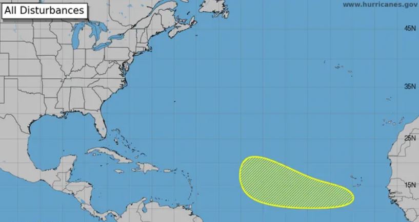
In the Atlantic, the US National Hurricane Center (NHC) said a tropical wave is preparing to cross the West African coast in the next few days. Environmental conditions are considered favorable for the slow development of this system. If it strengthens, the new storm could be named Gabrielle.
Meteorologist Matt Lanza (Houston, USA) said that most forecast models are quite opted about the possibility of storm formation in the next week, with the trajectory moving out of the mid- Atlantic. However, experts emphasized that this system does not pose a direct threat to land.
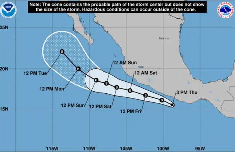
Meanwhile, in the East Pacific, the low pressure area off the southern coast of Mexico strengthened into tropical depression 13-E on September 12. The US National Hurricane Center predicts the system will move west-northwest, parallel to the coast, and could become a tropical storm named Mario.
Meteorological experts warn that up to 300mm of rain could fall in the southwestern coastal areas of Mexico, causing the risk of flash floods and landslides. If it continues to remain in warm water, the system could strengthen into a major storm in the next few days.
According to AccuWeather's latest hurricane forecast, the 2025 Atlantic hurricane season will have 13-16 named storms, of which 6-9 will strengthen into storms and 3-5 may reach major hurricane status. So far, six named storms have been named in the basin, down from the multi-year average.
The simultaneous appearance of potential storms Mirasol in the East Sea, Gabrielle in the Atlantic and Mario in the Pacific shows that the global tropical region is entering a period of strong activity, with the potential for a series of natural disasters in the coming weeks.