The latest storm and low pressure information on the morning of August 23 from the Philippine Atmospheric, Geophysical and Astronomical Services Administration (PAGASA) said that storm Isang (the name in the Philippines for storm No. 5 Kajiki) is moving in the East Sea.
Philippine typhoon forecasters say that typhoon No. 5 in the South China Sea will continue to move west throughout the forecast period.
The system strengthened into a tropical storm at 2 a.m. on August 23. Typhoon No. 5 Kajiki is forecast to continuously strengthen and may reach typhoon level when entering the sea area south of Hainan Island, China.
In addition to Typhoon No. 5 Kajiki, Philippine weather forecasters are also monitoring the development of low pressure 08f located east of the country. The low pressure near the East Sea 08f is outside the Philippine forecast area and is unlikely to develop into a tropical depression within the next 24 hours.
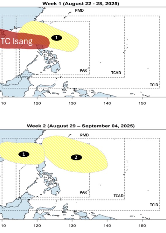
Previously, PAGASA's storm forecast on August 22 stated that when Typhoon No. 5 Kajiki is active in the East Sea, moving towards Hainan Island (China) and towards Vietnam, a low pressure near the East Sea is likely to form from August 22 to August 28 inside the PAR forecast area and then move rapidly towards the Border Strait - Balintang connecting the Philippine Sea and the East Sea. This low pressure is forecast to have little chance of strengthening into a storm during the period of moving towards the East Sea.
However, this system is expected to continue to exist until the week of August 29 to September 4 and enter the East Sea. The low pressure is forecast to enter the northwest boundary of PAGASA's PMD forecast area and head south of China.
Also during the forecast period, another low pressure will develop in the northern area of the Philippine Sea. This low pressure is forecast to have little chance of strengthening into a storm or tropical depression.
Regarding the development of storm No. 5 Kajiki in the East Sea, the quick bulletin at 9:00 a.m. on August 23 of the Vietnam National Center for Hydro-Meteorological Forecasting said that the center of the storm was at about 17.3 degrees North latitude; 116.1 degrees East longitude, about 420km east-northeast of Hoang Sa Special Zone. Maximum wind speed: Level 8 (62-74 km/h), gust level 10. Forecast: In the next 3 hours, the storm will move west-northwest, at a speed of about 25 km/h.
The emergency storm bulletin on storm No. 5 issued by the Vietnam National Center for Hydro-Meteorological Forecasting at 8:00 a.m. on August 23 predicts that due to the influence of storm No. 5, from the afternoon of August 24, the sea area from Thanh Hoa to Hue (including Con Co, Hon Ngu): There will be winds gradually increasing to level 6-8, then increasing to level 9-10, the area near the storm center will pass level 11-12, gusting to level 15. Waves are 4.0-6.0m high, near the center 6.0 8.0m. The sea is rough.
From the night of August 24, the northern sea area of the Gulf of Tonkin (including Bach Long Vi): There will be winds gradually increasing to level 6-7, gusting to level 9. Waves are 2.0-3.0m high. Rough seas.
On land, from the night of August 24 to the end of August 26, the Northern Delta and Thanh Hoa - Hue will have widespread heavy rain, with common rainfall of 100-150mm, locally >250mm. Thanh Hoa - Quang Tri will have heavy to very heavy rain, with common rainfall of 150-300mm, some places >600mm.
September 25-26: Hanoi and Da Nang have moderate rain, heavy rain and thunderstorms. Ho Chi Minh City has rain, showers and thunderstorms in the late afternoon and evening. During thunderstorms, beware of tornadoes and strong gusts of wind.