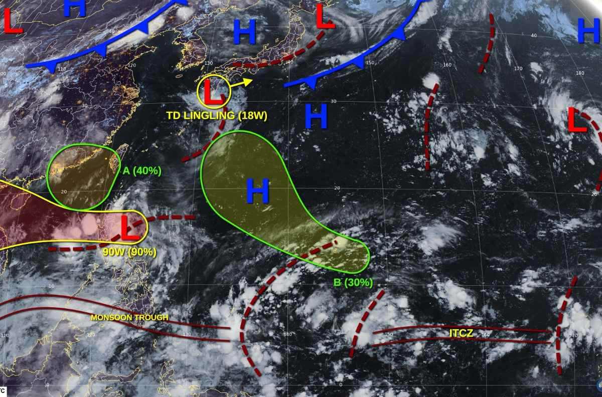
The storm/low pressure information from the Philippine Atmospheric, Geophysical and Astronomical Services Administration (PAGASA) said that at 3:00 a.m. on August 22, the center of the low pressure was determined to be about 150km east of Baler, Aurora (Philippines), at 16.0 degrees North latitude, 123.0 degrees East longitude.
PAGASA forecasts that this low pressure area (code LPA 08e) is very likely to develop into a tropical depression today and will soon be locally named one one one one.
According to the forecaster of storm Grace Castañeda, if the low pressure area strengthens into a tropical depression today, many localities in the Central and Northern Philippines will immediately be warned of strong winds of level 1.
The low pressure is expected to move westward, into mainland Luzon, then move out into the East Sea overnight on August 22 or the morning of August 23.
As soon as it enters the East Sea, the tropical depression will encounter favorable conditions: high sea surface temperature (29-30 degrees Celsius), rich southwest monsoon, low wind shear. Thanks to that, the tropical depression is likely to continue to strengthen into a storm, moving towards the North of Hoang Sa archipelago (Vietnam) and the South of Hainan Island (China) on August 24.
By around August 25, the storm is forecast to head straight into the Gulf of Tonkin, directly affecting the sea and mainland of the North Central provinces, especially from Quang Binh to Thua Thien - Hue, while expanding the scope of impact to the entire Northern region.
Forecasts from international models show that storm No. 5 is likely to cause widespread heavy rain in mainland Vietnam from August 25 onwards. The most severely affected areas will be the Northern, North Central and coastal areas from Quang Binh to Hue.
There is a high risk of high-intensity rain in a short period of time, flash floods and landslides in mountainous provinces, flooding in low-lying areas. Coastal provinces are warned to face strong gusts of wind, big waves, and dangerous rising water.
Meteorological experts emphasized that this is a tropical cyclone system with a fast moving speed, strong increase in intensity in a short time and a complex trajectory, a very wide range of influence.
Regarding the forecast of heavy rain in Vietnam on August 22, the Vietnam National Center for Hydro-Meteorological Forecasting said that from early morning to the night of August 22, the mountainous areas of the North will have moderate rain, heavy rain; common rainfall is 30-60mm, locally over 150mm.
On the day and night of August 22, other places in the North, Thanh Hoa, from Quang Tri to Quang Ngai, Central and Southern Plateau will have scattered showers and thunderstorms; rainfall of 10-30mm, locally over 70mm.
Risk of local heavy rain over 100 mm/3h.
There is a risk of flash floods, landslides, and land subsidence on steep slopes and small streams in Son La, Phu Tho, Lao Cai, Tuyen Quang, Thai Nguyen, and Cao Bang provinces.
Regarding today's weather forecast in Hanoi: Lowest temperature 25-27 degrees Celsius, highest temperature 31-33 degrees Celsius. Occasionally showers and thunderstorms, intermittent sunshine during the day. Southeast wind level 2-3. During thunderstorms, there is a possibility of tornadoes, lightning and strong gusts of wind.


