The latest storm and low pressure information from the Philippine Atmospheric, Geophysical and Astronomical Services Administration (PAGASA) said that after the tropical depression on land affecting Vietnam's weather and tropical depression Huaning heading south of Japan and South Korea, there are expected to be 3 consecutive low pressure areas around the East Sea.
Philippine weather forecasters said that during the week of August 18 to August 24, a low pressure near the East Sea is forecast to form at the western boundary of the Philippine Forecast Area (PAR) and PAGASA's TCAD forecast area.
Philippine forecasters say the low pressure is likely to strengthen from low to moderate. This low pressure near the East Sea is expected to head towards the northeast of Northern Luzon, Philippines.
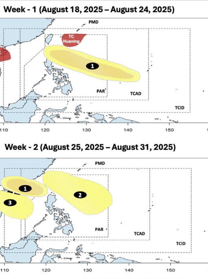
During the week from August 25 to August 31, the low pressure near the East Sea is expected to enter the East Sea, heading towards Taiwan (China) and southern China. This low pressure is still likely to strengthen into a storm or tropical depression at low to moderate levels.
During the same forecast period, 2 other low pressure areas will form in the East Sea and near the East Sea. In which, the low pressure near the East Sea will form first, at the western boundary of the PAR. This low pressure is expected to move towards the North of Luzon, the Philippines and Taiwan (China). The low pressure in the East Sea will form later, expected to head towards Vietnam.