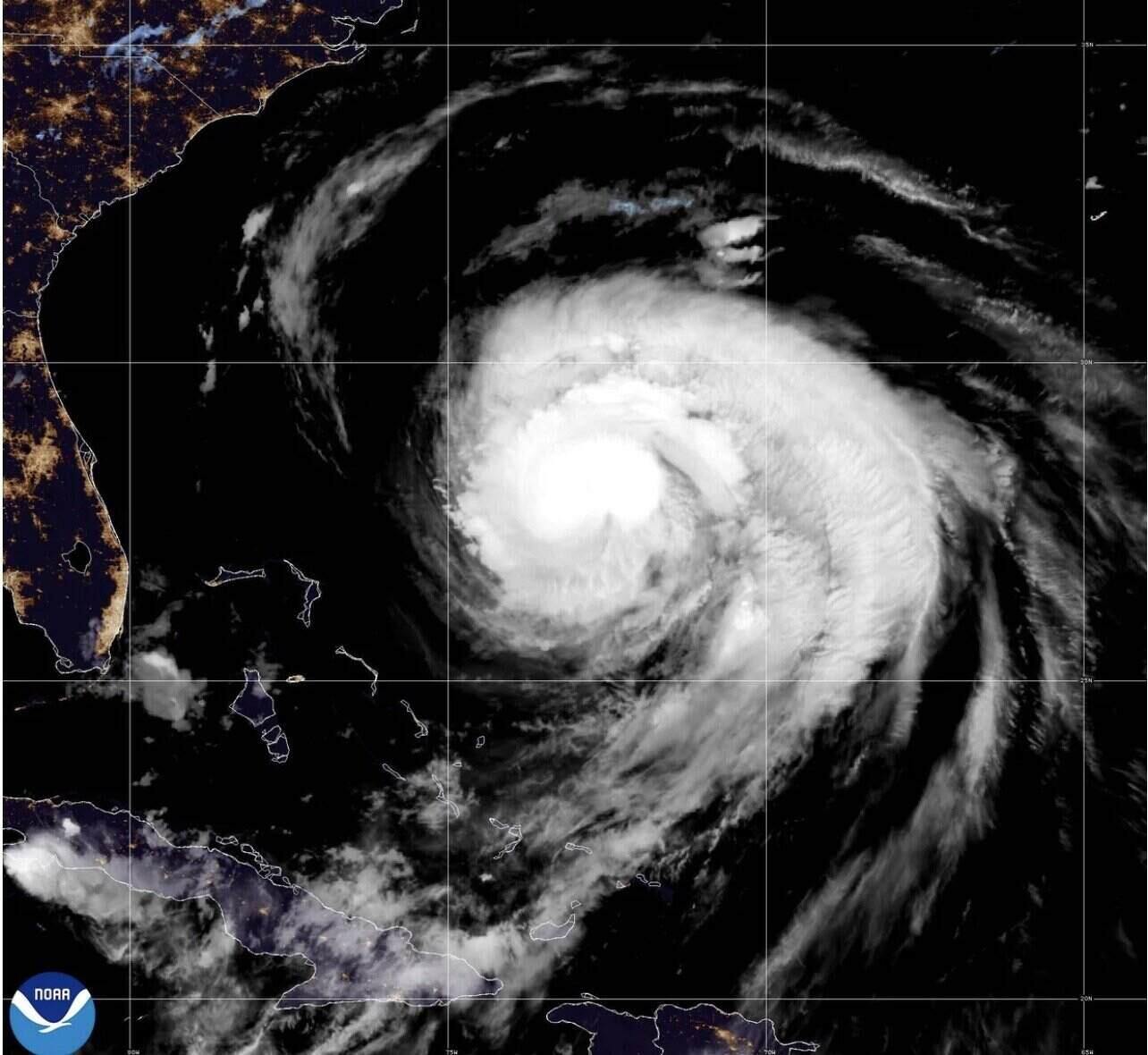
The latest hurricane information on August 20 from the US National Hurricane Center (NHC) in Miami said that Hurricane Erin, the first hurricane in the Atlantic in 2025, was downgraded to a Category 2 storm on the morning of August 19 as it moved from the northern Caribbean.
Satellite images and reports from US Air Force seaplanes show that Erin is "more organized and forecast to gradually strengthen until the night of August 21".
According to the NHC hurricane center, Erin is expected to threaten the East Coast of the United States, the Atlantic coast of Canada, the Bahamas and Bermuda with "life-threatening waves and offshore flows" in the next few days.
The warning means "swimming at most beaches on the East Coast of the United States will remain dangerous for the next few days," the center said in its hurricane bulletin on the morning of August 20.
At 2:00 a.m. on August 20, Erin was at level 2, with maximum sustained winds of 161 km/h and moving at a speed of 21 km/h. The center of the storm is about 917km west-southwest of Bermuda and about 797km south-southeast of Cape Hatteras, North Carolina, USA.
Forecasters note that the intensity of Erin could fluctuate over the next few days. The center of the storm is expected to move across the western Atlantic, between the East Coast of the United States and Bermuda from August 20 to the morning of August 22, then cross the Atlantic coast in southern Canada on August 23 and 24.
Forecast models show that an Atlantic high pressure system is expected to push Erin further off the U.S. coast, while a cold front is also expected to continue pushing the storm further off the coast.
Erin is not expected to make landfall directly in the US. However, according to forecasters, the worst weather conditions due to the storm's impact are expected to occur from the night of August 20 to August 21, when the center of Hurricane Erin is expected to be closest to the coast.
At that time, severe flooding could affect buildings and roads along the Outer Banks. Many roads may be deeply flooded and inaccessible for several days due to flooding.
Compulsory evacuation orders have been issued for Hatteras Island and Ocracoke Island in Outer Banks ahead of the expected flooding.
Hurricane Erin is expected to cause dangerous offshore flows along the Jersey coast and the southern beaches of New York. This risk will last throughout the week.
Erin was a tropical storm that formed last week in the western part of the Cabo Verde archipelago, several hundred kilometers off the west coast of Africa. This is the fifth storm of the 2025 Atlantic hurricane season.
Erin strengthened into a typhoon on August 15. Erin strengthened to Category 5 on August 16 and weakened to Category 3 on the morning of August 17, and continued to strengthen late on August 17, at times reaching Category 4.