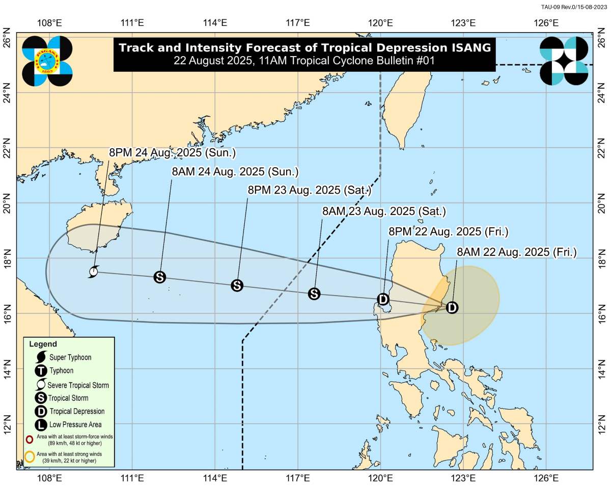
The latest storm information from the Philippine Atmospheric, Geophysical and Astronomical Services Administration (PAGASA) said that tropical depression Isang made landfall in Casiguran, Aurora (Philippines) on the morning of August 22, causing 21 provinces across Luzon to broadcast storm signals.
At 11:00 on August 22, PAGASA recorded the strongest winds of the tropical depression at 55 km/h, gusting up to 90 km/h when it made landfall at 10:00 a.m.
The tropical depression is moving west at a speed of 15 km/h.
PAGASA warned that many areas of Luzon could see winds of 39-61 km/h in the next 36 hours, posing threats to life and property.
The southwest monsoon, enhanced by the tropical depression Isang, is expected to bring strong gusts to typhoon-force winds over Aurora, Zambales, Bataan, Manila Urban Area, Calabarzon, Mimaropa, Bicol, Western Visayas, Central Visayas and parts of Mindanao, including Dinagat Islands, Surigao del Norte and Camiguiguin.
Although no strong gusts have been warned, rough seas with waves as high as 3 meters are expected off the coast of Batanes and Cagayan, where PAGASA has advised small ships and motorboats not to go to sea.
Meanwhile, according to the storm forecast of the Vietnam National Center for Hydro-Meteorological Forecasting, by 10:00 a.m. on August 23, the tropical depression will strengthen into a storm, becoming the fifth storm in the East Sea.
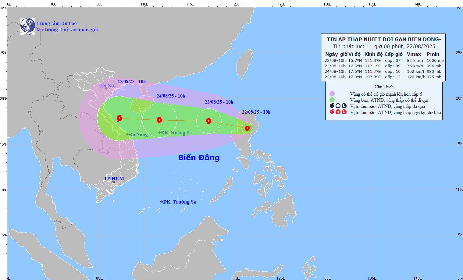
The center of the storm is located at 17.5 degrees North latitude, 117 degrees East longitude; in the eastern sea of the North East Sea; 560km East Northeast of the Hoang Sa Special Zone. The strongest wind near the storm center is level 8-9, gusting to level 11.
It is forecasted that by 10:00 on August 24, the center of the storm will be at 17.6 degrees North latitude, 111.7 degrees East longitude; in the sea north of the Hoang Sa special zone. The strongest wind near the storm center is level 10-11, gusting to level 14.
From the next 48 to 72 hours, the storm will move mainly in the West direction, traveling about 20km per hour and is likely to strengthen.
Forecast of the impact of the tropical depression after strengthening into a storm: The eastern sea area of the North East Sea will have showers and thunderstorms, strong winds of level 6-7, then increasing to level 8-9, gusts of level 11, waves 3.0-5.0m high, very rough seas.