The latest storm and low pressure forecast by the Philippine Atmospheric, Geophysical and Astronomical Services Administration (PAGASA) on January 31 said that a new low pressure is expected to appear near the Philippines in early February 2025.
PAGASA's latest forecast states that a new low pressure near the Philippines is expected to appear south of PAGASA's PAR and TCAD forecast areas during the period from January 31 to February 6.
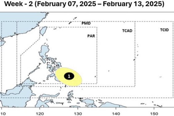
Forecasters say this low pressure will continue to move northwest and expand in size during the week from February 7 to February 13.
During the forecast period, PAGASA weather experts said that the new low pressure near the Philippines is unlikely to strengthen into a storm.
This is expected to be the first low pressure area recorded near the Philippines in 2025. If the new low strengthens into a storm and enters the Philippine PAR forecast area, the storm will be named Auring.
Previously, in the forecast bulletin dated January 27, PAGASA stated that a new low pressure is expected to form in the southeast of the Philippines during the week from February 3 to February 9. The low pressure appears in the southeast area of PAGASA's TCAD and PAR forecast areas.
The low pressure system near the Philippines is forecast to move closer to the east of Mindanao and the Visayas. Forecasters at the time said the low pressure system could potentially become the first typhoon of 2025 during the week of February 3 to 9, with a low to moderate chance of becoming a typhoon.