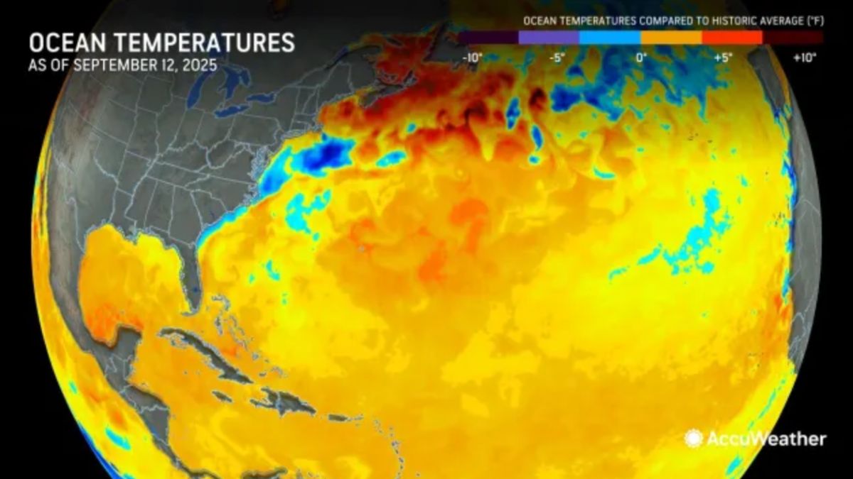
AccuWeather's latest storm news warns that the Gulf of Mexico and the western Caribbean will be a "hot spot" for storms in the second half of September, when sea temperatures hit record levels, creating conditions for the storm to strengthen rapidly and almost no time to prepare for coastal residents.
AccuWeather said that from around September 18 to the end of the month, the western Caribbean and the Gulf of Mexico will need to be closely monitored. A storm could form in the area and move toward the United States. Because they form too close to land, storms will leave little preparation time for coastal residents, said Alex DaSilva, a hurricane forecaster at AccuWeather.
On average, a tropical depression forming in the northwest Caribbean could take 3-5 days to approach the United States. If it had formed in the Gulf of Mexico, the time could have been shortened to just 2 days. With sea surface temperatures reaching nearly 32 degrees Celsius, far exceeding the 27 degrees Celsius threshold needed for the storm to develop, storms in the Gulf of Mexico are likely to rapidly strengthen.
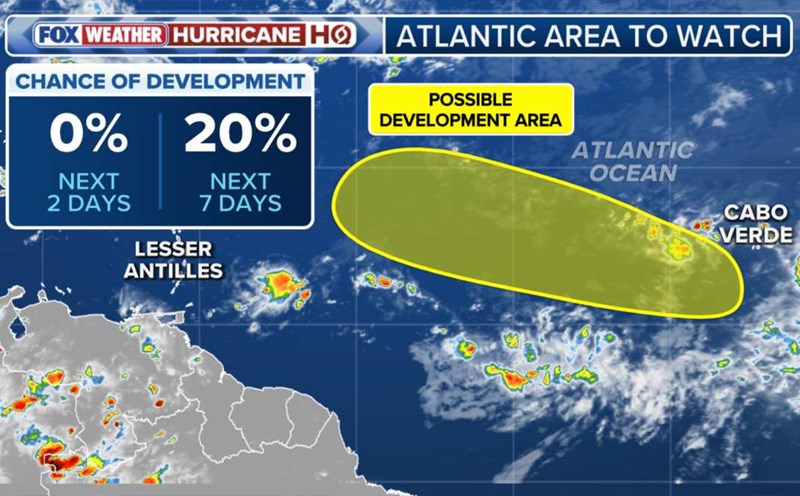
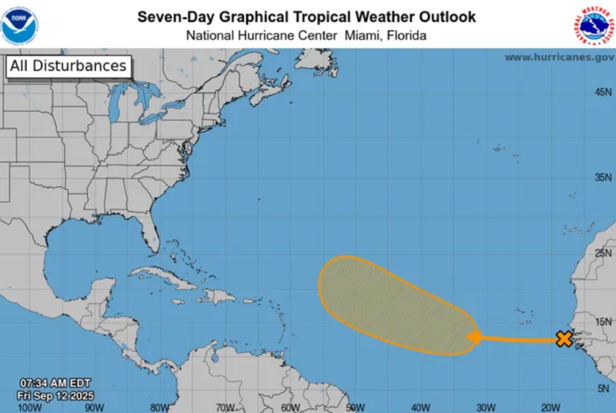
AccuWeather forecasts a significant increase in tropical storm activity in the second half of September. On September 14, there were two notable tropical disturbances from off the coast of Africa, which could develop into low pressure or a storm as they move across the warm Atlantic.
"Unfavorable conditions such as strong wind shear, dry air or Sahara dust will decrease next week. This means that any tropical wave traveling from Africa to the Atlantic could be the focus of attention, DaSilva said.
The same assessment, the US National Hurricane Center (NHC) said the low pressure off the coast of Africa is likely to become a tropical depression by mid-next week and could strengthen into storm No. 7 Gabrielle. However, many forecasts suggest that the system will deviate to the sea rather than heading straight into the US mainland.
In parallel with the Atlantic, the Pacific Ocean recorded Tropical Storm Mario forming on September 12 off the coast of western Mexico. This is the 13th storm of the 2025 typhoon season in the eastern Pacific. Superstorm Mario is forecast to move parallel to the southwest coast of Mexico, potentially causing 50-150 mm, even 150 mm, heavy rain in mountainous areas, increasing the risk of flash floods and landslides.
Meteorologists believe that the phenomenon of "record warm ocean waters" is not limited to the Atlantic or Gulf of Mexico but also spreads globally, including the Northwest Pacific, where the East Sea is located in the area directly affected.
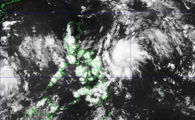
In September, the Vietnam Meteorological Agency also closely monitored low pressure from the east of the Philippines, which is likely to strengthen into a storm when entering the East Sea. The law shows that the closer to the end of September, the more the frequency of storms and the trajectory tends to be complicated, easily affecting the Central and Northern regions of Vietnam. The East Sea is forecast to have at least 2 tropical depressions/storm in the second half of September.
Currently, the Philippine Atmospheric, Geophysical and Astronomical Services Administration is monitoring low pressure 09c with the possibility of strengthening into a tropical depression or storm Mirasol in the East Sea.