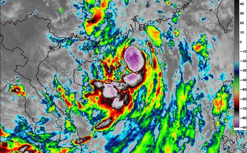
According to the latest storm forecast, there will be no low pressure or storms near the East Sea until the end of the week, but many areas are still forecast to have heavy rain.
The Philippine Atmospheric, Geophysical and Astronomical Services Administration (PAGASA) said that from now until the end of the week, the possibility of low pressure/storm formation in the Philippine monitoring area (PAR) is still low.
However, according to the general forecast for the Northwest Pacific - East Sea, September is often the peak of the storm season with 2-3 low pressure or storms that may appear, which may directly affect the East Sea.
PAGASA said on September 9 that the Philippines has not been affected by low pressure or storms in the East Sea this week, but localized thunderstorms are still possible.
PAGASA weather forecaster Obetrina Badrina emphasized: "No low pressure areas have been recorded on the map at this time. By the end of the week, the likelihood of typhoon formation within the Philippines' forecast area remains low, he said.
On September 10, the easterly winds from the Pacific are forecast to continue causing scattered rain in the Bicol region. The remaining areas across the country may experience localized thunderstorms, especially in the late afternoon and evening.
From September 11 to 13, the weather is generally forecast to be favorable, mainly sunny. However, PAGASA warned that localized thunderstorms in the afternoon or evening may still occur, bringing heavy rain, strong winds, thunderstorms and occasional hail. These phenomena usually last about 3 hours.
According to the National Center for Hydro-Meteorological Forecasting (Vietnam), in September 2025, it is forecasted that there will be about 2-3 storms or tropical depressions active in the East Sea. Of these, 1-2 storms are likely to directly affect the mainland of Vietnam, concentrated in the Central and Northern regions.
Experts note that coastal residents need to closely monitor storm forecasts, as storm developments in September are often fast and complicated.
Regarding rain forecast, from the evening of September 9 to the night of September 10, the mountainous and midland areas of the North will have moderate rain, heavy rain and scattered thunderstorms, with common rainfall of 50-100mm, locally over 200mm. Risk of heavy rain >100 mm/3 hours.
From September 11, heavy rain in the mountainous and midland areas of the North will gradually decrease.