According to the latest storm information from the US Joint Typhoon Warning Center (JTWC), a low pressure area (temporarily identified as 91W Invest) has just been identified to appear in the southeast of Palawan Island (Philippines), about 200 km east of Truong Sa archipelago of Vietnam.
Although it has not yet reached the tropical storm threshold, this system is causing widespread heavy rain and has favorable conditions for further development in the next few days.
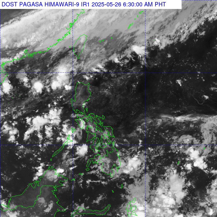
According to observation data at 3:00 p.m. on May 25, the low pressure area has an average wind speed of about 35 km/h, central pressure reaching 1008 mb, and is assessed as a weak tropical depression.
Rainfall in the district center is up to 1.02 mm/minute, equivalent to very heavy rain, mainly concentrated in the east of Palawan Island.
The cloud shape in the central area shows the appearance of high-altitude clouds (Cumulonimbus) - characteristic of extreme weather. The measured cloud temperature was -58.1 degrees Celsius, showing the strong development of convection.
The sea surface temperature will reach about 30 degrees Celsius - a very warm level, creating favorable conditions for the development of tropical systems.
High-level wind shear at 23.2 km/h from east to east-southeast is considered favorable, helping the system maintain convective structure.
According to storm forecast models, low pressure area 91W is unlikely to strengthen into a storm in the next 24 hours, with a slow movement speed of 5.6 km/h in the west-northwest direction, mainly affecting the central Philippines and the sea area east of Truong Sa.
The Philippine Atmospheric, Geophysical and Astronomical Services Administration (PAGASA) forecasts that the combined influence of the low pressure and tropical convergence zone will cause widespread showers and thunderstorms in the Bicol, Visayas, Palawan and Mindanao regions.
The Vietnam National Center for Hydro-Meteorological Forecasting said that on May 26, the north of the Gulf of Tonkin, the north of the North East Sea, will have northeast winds at times at level 6, gusting to level 7-8, rough seas; waves 1.0-3.0m high.
Gulf of Tonkin, the sea area from Quang Tri to Quang Ngai, Binh Thuan to Ca Mau, Ca Mau to Kien Giang, the Gulf of Thailand, the East Sea area (including the sea areas of Hoang Sa archipelago and Truong Sa) will have showers and thunderstorms. During thunderstorms, there is a possibility of tornadoes, strong gusts of wind of level 6-7 and waves over 2m high.
On the night of May 26 and May 27, the wind in the northern Gulf of Tonkin, the northern sea area of the North East Sea, will gradually decrease. Natural disaster risk level: Level 2.
Regarding rain forecast, on May 26, South Nghe An to Quang Binh will have moderate rain, heavy rain and thunderstorms, locally very heavy rain with common rainfall of 20-50mm, locally over 100mm.
On the day and night of May 26, Quang Tri to Quang Ngai will have scattered showers and thunderstorms, locally heavy rain with rainfall from 10-30mm, some places over 50mm.
In the afternoon and evening of May 26, the South will have scattered showers and thunderstorms, locally heavy rain with rainfall from 10-30mm, some places over 50mm.
From the night of May 26, heavy rain in the Central region will gradually decrease.
Warning of the risk of local heavy rain >80mm/3 hours.


