
According to storm news, the latest low pressure from the Japan Meteorological Agency (JMA), Tokyo warned of heavy rain, strong winds, flooding and landslides as Typhoon Dujuan moves towards the eastern Pacific coastal area on September 21.
According to JMA, at 10 am on September 21 (local time), Typhoon Dujuan was about 100km west-southwest of Hachijo Island in the Izu Islands, moving north at a speed of 25 km/h. The typhoon has a central pressure of 960 hPa, with strongest gusts of up to 198 km/h.
This is the 25th storm of the year. The storm is forecast to move near the Boso Peninsula, Chiba Prefecture, east of Tokyo, from evening to night on September 21.
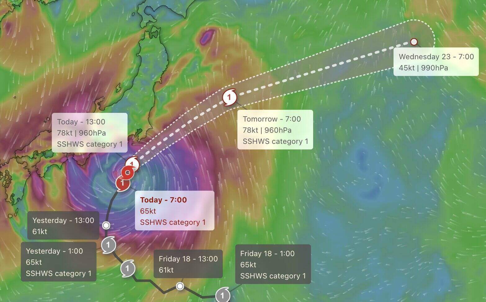
Heavy rain has poured down on the Kanto-Koshin area in the east and Tokai in the central region. Many cities in Chiba recorded flooded streets, while JMA issued a level 4 danger warning for landslides in some areas.
In 24 hours as of 7:40 am on September 21, Izu Oshima recorded rainfall of 387.5 mm, while Kimitsu, Chiba Prefecture had 283.5 mm. JMA forecasts that in 24 hours to 7:00 am on September 22, rainfall could reach 350 mm in Tokai, 300 mm in Kanto and the Izu Islands, and 200 mm in Tohoku.
JMA warns people in the Izu, Kanto and Pacific coastal areas of Tokai and Tohoku to prevent landslides, strong winds, low-lying flooding, rising rivers and big waves. Urban residents are advised to avoid underground areas where water may accumulate and cause vehicles to get stuck.
Typhoon Dujuan approached right during the 5-day holiday in Japan, causing traffic disruption. Some highways have been closed, while high-speed train routes connecting Tokyo with the west are at risk of delays or cancellations in the afternoon of September 21.


