
According to the latest storm and low pressure news from the Philippine Atmospheric, Geophysical and Astronomical Services Administration (PAGASA), the tropical storm with the international name Dujuan, previously identified as low pressure area LPA 09d, has strengthened into a dangerous tropical storm.
According to updates at 2:00 PM on September 17 (Philippines time), Typhoon Dujuan is located about 2,920km northeast of Luzon, at 21.7 degrees North latitude and 150.0 degrees East longitude. The typhoon has maximum sustained winds of 95 km/h, gusts up to 115 km/h and is moving north at a speed of 50 km/h.
Typhoon Dujuan is currently still outside the Philippine Area of Responsibility (PAR).
According to forecasts, by September 18-19, the storm's center will continue to move northwest and approach the Ogasawara Island area, Japan, before turning north on September 20.
In terms of intensity, Dujuan's wind speed is forecast to slightly decrease from about 95 km/h currently to about 91 km/h on September 18-19, with a central pressure of about 985 hPa. By September 20, the storm can still maintain wind speeds of about 91 km/h, while the central pressure decreases to about 980 hPa.
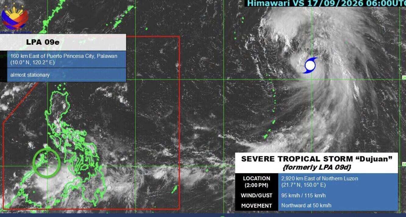
While Typhoon Dujuan is strengthening outside PAR, PAGASA is also monitoring another low pressure area inside this area.
As of 2 pm, low pressure LPA 09e is located about 160km east of Puerto Princesa city, Palawan province (Philippines), at 10.0 degrees North latitude and 120.2 degrees East longitude. The system is almost standing still.
PAGASA assesses that LPA 09e is unlikely to develop into a tropical depression in the next 24 hours. The agency recommends that people continue to closely monitor the latest updated information about Typhoon Dujuan and the LPA 09e low pressure.


