
According to storm and low pressure news from the Philippine Atmospheric, Geophysical and Astronomical Services Administration (PAGASA), tropical storm Dujuan has strengthened into a typhoon and is outside the Philippine Area of Responsibility (PAR).
According to information at 2:00 AM on September 19 (Philippines time), the center of Typhoon Dujuan is located about 2,015km northeast of the northernmost point of Luzon Island, at 26.2 degrees North latitude and 140.7 degrees East longitude. The typhoon has the strongest wind near the center of 120 km/h, gusting up to 150 km/h, moving northwest at a speed of about 20 km/h.
PAGASA monitoring images show that Dujuan is far from Philippine territory and has not entered PAR. Forecast data also shows that the storm will continue to move over the eastern Philippine waters in the coming days.
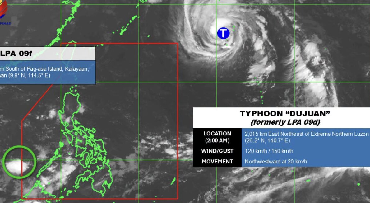
Forecasts show that Typhoon Dujuan will continue to maintain intensity on September 20, with winds of about 126 km/h and central pressure of about 970 hPa. On September 21, winds will decrease to about 104 km/h, while pressure will increase to about 980 hPa. By September 22, the typhoon will continue to weaken, with winds of about 97 km/h and central pressure of about 985 hPa.
Typhoon Dujuan is ranked level 1 on the Saffir-Simpson scale. However, PAGASA said that this system was not forecast to enter PAR and did not directly affect the Philippines and surrounding areas.
Meanwhile, a low pressure area LPA 09f is also being monitored by PAGASA outside PAR. This system is located about 140km south of Kalayaan Island, Palawan province (Philippines), at 9.8 degrees North latitude and 114.5 degrees East longitude.
PAGASA assesses that LPA 09f is unlikely to develop into a tropical depression in the next 24 hours and recommends that people continue to follow official updates.


