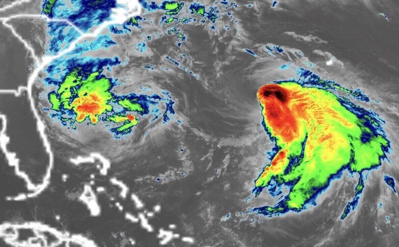
The latest typhoon information from the Hong Kong Meteorological Station (China) on October 2 said that the center of typhoon Matmo was about 610km east of Manila, Philippines at noon and was moving west-northwest at a speed of about 22km/h, towards the vicinity of Luzon and continuing to strengthen.
" Matmo will sweep across Luzon, then enter the central and northern part of the South China Sea. Next, the storm will move around the western coast of Quang Dong province to the east of Hainan Island. However, the intensity of the storm is still uncertain," the bulletin said.
According to Hong Kong (China) weather forecasters, due to the influence of Typhoon No. 11 in the East Sea, strong winds accompanied by scattered showers will be recorded in the southern coast of China over the weekend.
The Taiwan Weather Administration - CWA (China) forecasts that Typhoon Matmo will move into the East Sea overnight on October 3, gradually strengthening and approaching the eastern coastal areas of the eastern, central and western regions of Hainan Island, China.
Matmo's path is expected to be about 300km south of Hong Kong (China) on October 4, with maximum winds near the center of the storm reaching 110 km/h.
CWA forecaster Lin Ting-yi said that Typhoon Matmo will make landfall on the Philippine island of Luzon before entering the East Sea, heading towards Vietnam.
He said that due to the impact of Typhoon No. 11 in the East Sea, Taiwan (China) may record the heaviest rain of the week on October 3 and 4, with thunderstorms expected in the eastern and southern regions, as well as mountainous areas of the island.
Matmo - meaning "heavy rain" in the Chamorro language of Guam - will be the fourth typhoon to affect Hong Kong (China) in the past 5 weeks.
Typhoon No. 11 Matmo appeared just a few days after Super Typhoon Ragasa - the ninth typhoon in the East Sea - paralyzed people's lives in Hong Kong (China) for 2 days last week.
The impact of storm No. 11 in the East Sea will make the weather worse during the Mid-Autumn Festival on October 6, with heavy rain and strong winds.
On October 4, Typhoon Matmo is expected to be 420km south of Hong Kong (China), with winds of up to 145km/h at the center of the storm.
By October 5, storm No. 11 will intensify violently, with sustained winds of up to 175km/h at the center of the storm southeast of Zhejiang and within the province of Guangdong, China.
Last week, Typhoon Ragasa was 120km south of Hong Kong (China), activating a Category 10 typhoon warning signal.
Ragasa is believed to have caused billions of dollars in damage when paralyzing Hong Kong (China) for 2 days, damaging restaurants, injuring at least 101 people and more than 1,200 trees broken and fallen.
Typhoon Tapah in the East Sea activated warning signal No. 8 in Hong Kong (China) in early September, while Typhoon Mitag brought heavy rain and severe thunderstorms here just two weeks after Tapah.