According to the Joint Typhoon Warning Center (JTWC), Typhoon Matmo is moving in the West Northwest - Northwest direction at a speed of about 20km/h. It is forecasted that on October 4, the center of the storm will cross the northernmost part of Luzon Island and enter the East Sea, becoming the 11th storm in 2025.
The latest storm information from the Philippine Meteorological Agency (PAGASA) warned that Typhoon Matmo will bring heavy to very heavy rain to the provinces of Ilocos Norte, Cagayan, Isabela and Cordillera on October 2, accompanied by the risk of flash floods and landslides. Some coastal areas of Luzon have ordered evacuations and given students a day off.
When entering the East Sea, storm No. 11 is forecast to encounter favorable conditions with high sea surface temperatures (29-30 degrees Celsius) and weak upper winds, causing the storm to likely strengthen to level 12-13. Forecast models agree that the storm will move towards the central East Sea in the next 2-3 days.
However, Matmo's further direction is still wrong. The storm may change direction to the north of the East Sea, directly affecting Hainan and China, or the storm may move westward, directly affecting the central or northern regions of Vietnam this weekend.
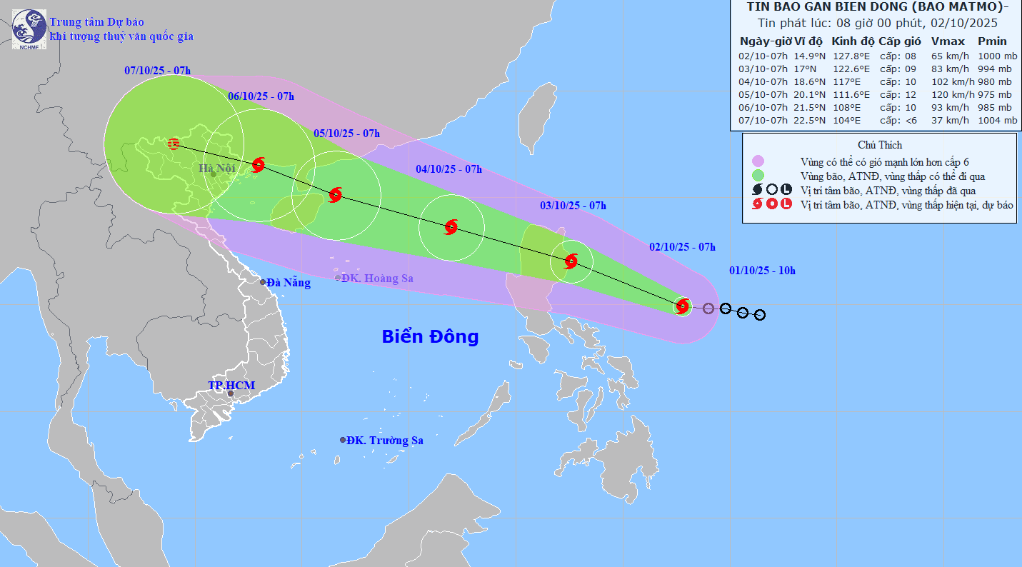
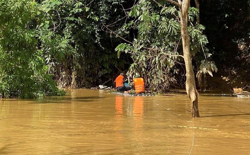
Currently, the National Center for Hydro-Meteorological Forecasting is closely monitoring the developments of storm Matmo. The agency said the storm is likely to cause strong winds and large waves across the East Sea from October 2. The Central and Northern coastal provinces need to prepare scenarios to respond to heavy rain, widespread flooding and the risk of flash floods in mountainous areas.
Meanwhile, in the Philippines, authorities have warned coastal residents to stay away from offshore fishing and sea transportation for at least the next 48 hours. Flights at Ninoy Aquino International Airport, Manila have also been delayed or diverted due to the impact of the storm.
" Matmo is gaining strength faster than expected," said PAGASA meteorologist Edgar Servando. People should not be subjective because this storm may get stronger when it enters the East Sea".
Due to climate change, recent storms tend to increase rapidly in a short time, making it difficult to respond. Matmo is expected to be one of the strongest storms of the 2025 typhoon season in the Northwest Pacific.