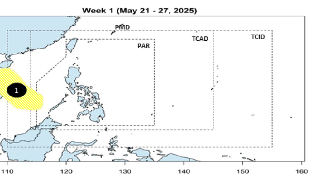
The latest storm news of the Department of Astronomy, Geophysics and Philippine atmosphere said that during the week from 21-27.5.2025, the low pressure near the East Sea is no longer in the Par forecasting area of the Philippines. The likelihood of low pressure developed into a storm this week is underestimated.
During the week of June 28-30, 2025, the low pressure near the East Sea is forecast to continue to exist but is unlikely to develop into a storm, and tends to move north-northeast, towards Taiwan (China).
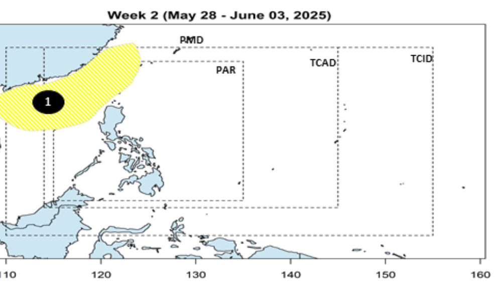
Thus, the risk of storm formation near the East Sea in the next 2 weeks is very low. However, forecasters emphasize that the forecast pattern may change as atmospheric conditions become complex.
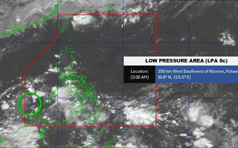
PAGASA warned that most areas across the country will see rain in the coming days due to the influence of low pressure, the tropical convergence zone and the easterly wind.
The tropical convergence zone affects Mindanao, Western Visayas and the Negros Island. This phenomenon can cause moderate to heavy rain, accompanied by strong thunderstorms, with the potential risk of flash floods and landslides in steep terrain areas or areas prone to flooding.
Meanwhile, according to the Vietnam National Center for Hydro-Meteorological Forecasting, from the night of May 22 to May 23, in the Northern region, there will be moderate rain, heavy rain and thunderstorms, locally very heavy rain with common rainfall of 40-90mm, locally over 150mm.
Heavy rain in the Northern region is likely to last until around May 24 with common rainfall from 30-60mm, some places over 100mm, from the night of May 24, heavy rain in the Northern regions tends to decrease gradually.
From the evening and night of May 23 to the night of May 24, heavy rain is likely to spread to the North Central region with common rainfall from 40-100mm, some places over 150mm.
During thunderstorms, tornadoes, lightning, hail, and strong gusts of wind may occur. Natural disaster risk level due to heavy rain: level 1.