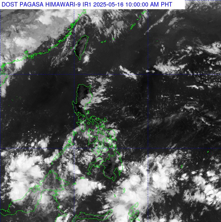
The Philippine Atmospheric, Geophysical and Astronomical Services Administration (PAGASA) warned on the afternoon of May 15 that the tropical convergence zone (ITCZ) is active in the Mindanao area and is likely to form a circulation and this circulation could develop into a low pressure near the East Sea in the next few days.
According to the latest storm news, the ITCZ is causing scattered showers and thunderstorms in Mindanao, Eastern Samar and Palawan. This type of unstable weather is expected to last in the coming days, as the circulation forming in the convergence zone is likely to become a low pressure area.
PAGASA recommends that people living in low-lying and flood-prone areas in Mindanao, Palawan and Eastern Samar prepare response plans, as heavy rains can cause flash floods, landslides and localized flooding.
Meanwhile, in the capital Manila and the rest of the Philippines, the impact of the winter wind will continue to cause scattered showers and thunderstorms at night. People are advised to be on guard against lightning, strong gusts of wind and sudden heavy rain.
At the same time, the Joint Typhoon Warning Center (JTWC) of the US is also monitoring tropical disturbances named Disturbance A, currently located south of Koror Island (Palau), not far from the East Sea. According to the JTWC, the system has formed a large low pressure area, with strong thunderstorms and gusts of wind of level 6-7.
Although circulation is still prolonged and unclear, current environmental conditions are considered favorable for the development of a low pressure or tropical storm this weekend, as the system moves through the Philippines.
The JTWC said that even if the disturbance does not develop into a storm, the entire Philippines could still experience widespread heavy rain from this weekend to early next week (from 175.-20). The focus of impact will include the central and southern Philippines, including Palawan - an area near the East Sea.
Current forecasts show that the likelihood of low pressure forming over the next 7 days is average, about 50%.
People and local authorities are advised to closely monitor further warnings from PAGASA and international meteorological agencies, especially as the low pressure system is likely to enter the East Sea - where strong storms often occur during the rainy season.
Meanwhile, the weather forecast bulletin of the Vietnam National Center for Hydro-Meteorological Forecasting said that from 2:00 a.m. to 8:00 a.m. on May 16, the areas of Ha Giang, Son La, Yen Bai, Tuyen Quang, Bac Kan and Cao Bang provinces had rain, some places had moderate to heavy rain, some places had very heavy rain such as: Tan Trinh 66.8mm (Ha Giang); Muong Gion 118.2mm (Son La); Che Tao 70mm (Yen Bai); Phao Tieu 100.2mm (Tuyen Quang); Yen Duong 106mm (Bac Kan); Truong Luong 146.4mm (Cao Bang);...
Soil moisture models show that some areas in the above provinces are nearly saturated (over 85%) or have reached a saturated state.
In the next 3-6 hours, the above provinces will continue to have rain with common rainfall from 20-50mm, some places over 80mm.