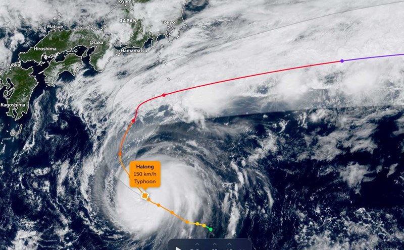
The latest storm news from the Japan Meteorological Agency (JMA) said that at 6:00 a.m. on October 8, Typhoon Ha Long (called Typhoon No. 22) was identified as a very strong storm with winds of 220 km/h, moving northward over the southern sea of the country. The storm is expected to approach the Izu Islands tonight and pass the southern region, including Hachijojima and Aogashima, on the morning of October 9.
The JMA warned that winds at the center of the storm could reach more than 250 km/h, giving a super typhoon - enough to blow away roofs, break power poles and collapse weak structures. Local authorities have urged coastal residents to evacuate early to avoid damage caused by high tides and flooding.
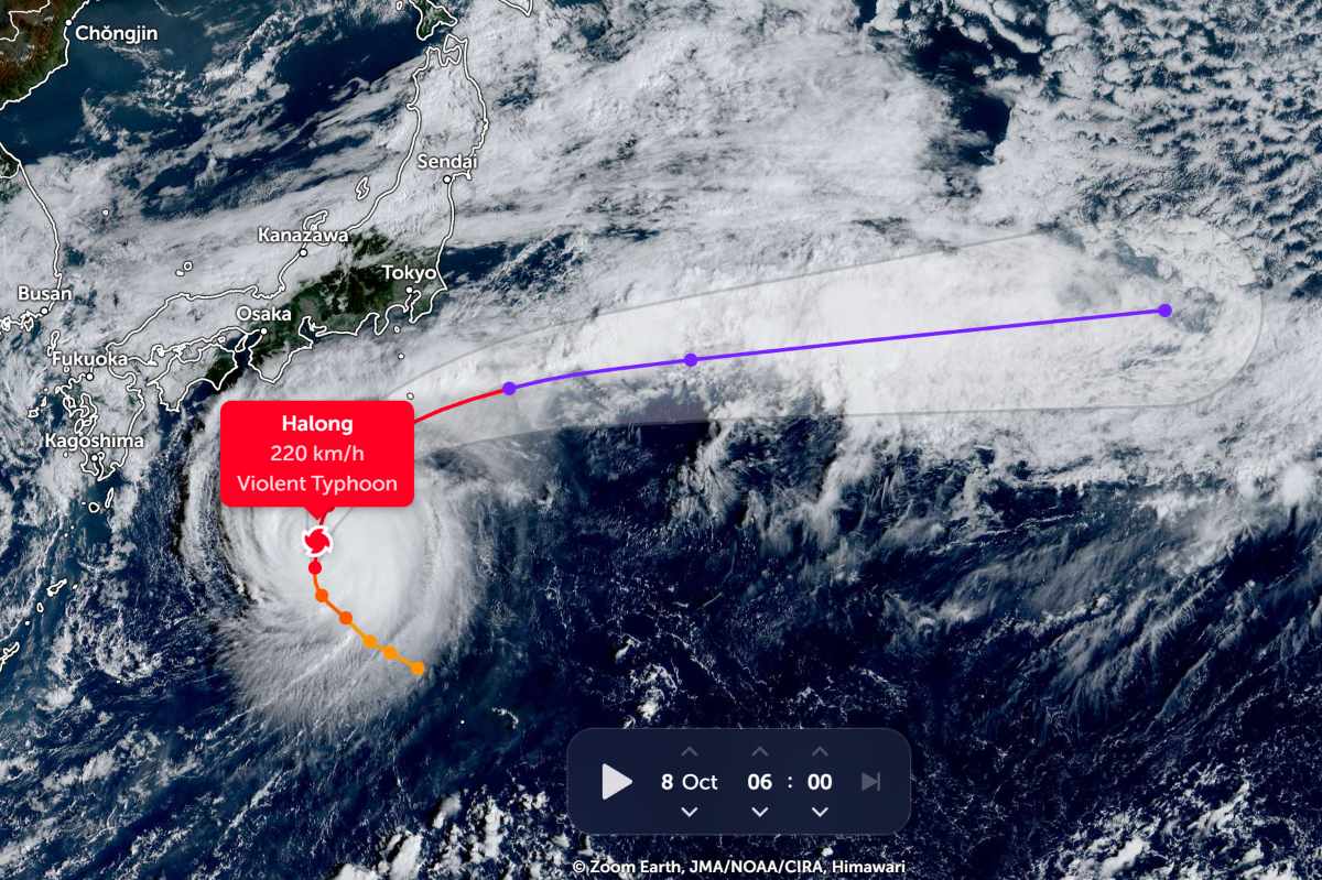
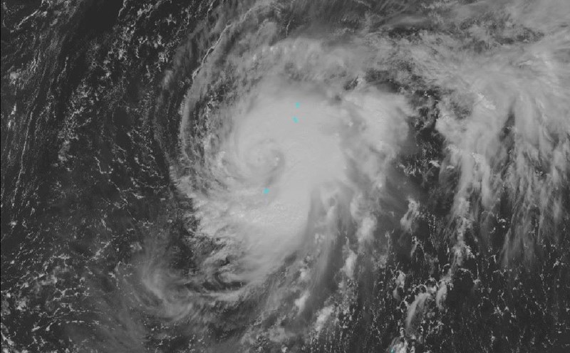
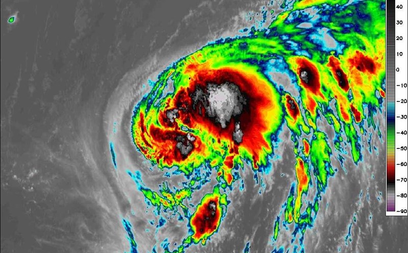
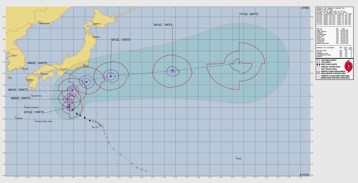
According to satellite data, storm Ha Long has rapidly intensified since the afternoon of October 7, with the strongest winds of 215-220 km/h, the central pressure has decreased to 942 hPa. Satellite imagery shows a large and clear eye, surrounded by extremely strong convective clouds - typical of a Category 4 storm on the Saffir-Simpson scale, and could reach super typhoon status (level 5) within the next 24 hours.
Storm forecasters said that storm Ha Long is moving slowly in the northwest - northeast direction, following the edge of the high pressure in the Pacific Ocean. The ideal atmospheric environment - weak wind shear, humid air, warm ocean waters - is helping the storm continue to strengthen before weakening when it meets colder waters in the north.
The total rainfall on the island of Hachijojima is forecast to reach 300mm by the night of October 9, and could be higher if the convective cloud bands remain for a long time. Japanese authorities have placed the area under the highest warning of the risk of landslides, flash floods and inundation.
Waves 8-10m high were recorded in the southern coastal area of Honshu Island. Several shipping routes and fishing ports have been suspended, while the Japan Defense Forces (JSDF) are ready for emergency response.
Although not forecast to make landfall directly, Typhoon Ha Long could still bring strong winds, large waves and extreme rain along the southern coast of Honshu for two days 8-9 October. People are advised to avoid going to the beach, postpone outdoor activities and prepare for the possibility of prolonged power outages.
At the US Navy base Yokosuka, the US military has raised the TCCOR 4 weather warning, requiring soldiers to limit outdoor travel.
Typhoon Ha Long is forecast to gradually weaken from the end of October 10, when it encounters cold air and strong wind shear in northeastern Japan. It is forecasted that in the next 4-5 days, Typhoon Ha Long will leave the Northwest Pacific Ocean, becoming an out-of-tropical cyclone near the Aleut Islands (USA) and may cause storms and snowfall in the Alaska region early next week.
Typhoon Ha Long is considered one of the strongest storms of the 2025 typhoon season in the Northwest Pacific, with perfect structure and the possibility of widespread devastation if it deviates from the approach to shore.
"Just a small change in the path can have serious consequences. People need to prepare for the worst case scenario, a JMA expert warned.