According to the latest storm news on October 7, Ha Long continues to move along the edge of the Pacific high pressure and is forecast to rapidly strengthen in the next few days.
Japan warned the Izu island region to prepare for severe gusts of wind, heavy rain and high waves as the storm reaches its peak on October 9.
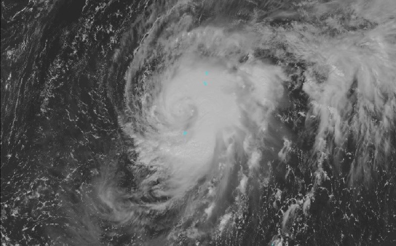
According to the Philippine Atmospheric, Geophysical and Astronomical Services Administration (PAGASA), at 4:00 a.m. on October 7, the center of Typhoon Ha Long was at about 26.6 degrees north latitude, 139.1 degrees east longitude, about 1,875 km east-northeast of Luzon Island (Philippines).
The strongest wind near the center of the storm is 130 km/h, gusting up to 160 km/h; moving west-northwest at a speed of about 15 km/h.
In the early hours of October 7, Typhoon Ha Long moved along the southern edge of the Pacific high pressure, expected to gradually turn north and then curve east around October 9.
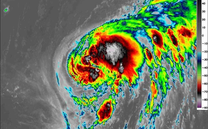
When moving in warm ocean waters - favorable conditions for development, Ha Long will strengthen into a "strong storm" on October 7 and reach a "very strong" level on October 9.
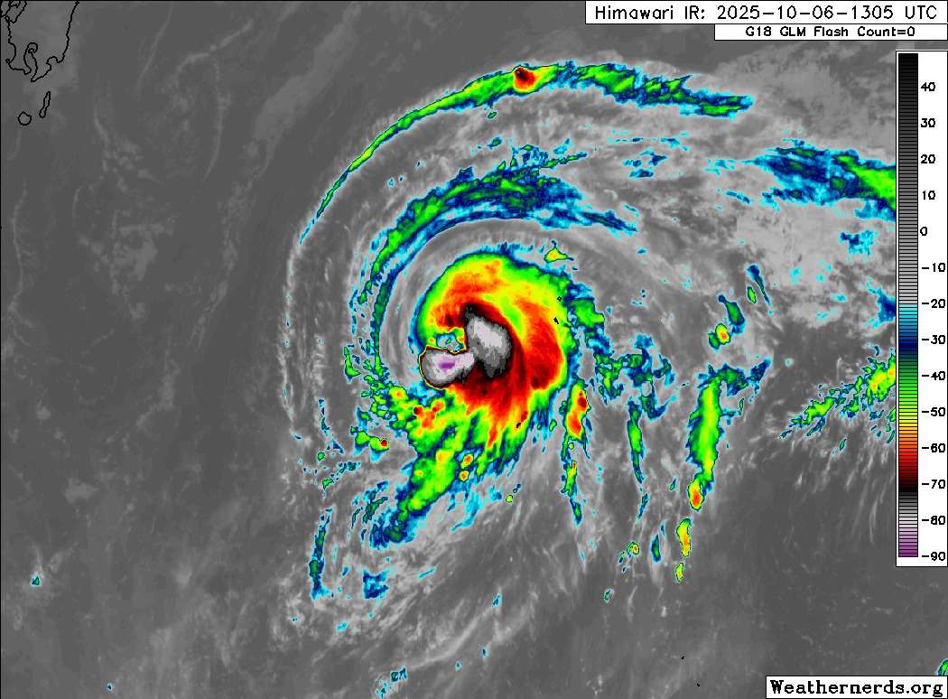
Satellite images show the center of the storm is currently located west of the Ogasawara Islands, with convective cloud bands being organized more tightly as the system continues to strengthen. It is expected that by the afternoon of October 8, winds near the center of the storm could reach 162 km/h, meeting the standards of a very strong storm according to Japan's classification scale.
It is forecasted that by 9:00 p.m. on October 9, storm Ha Long will maintain an average wind speed of about 162 km/h, gusting up to 234 km/h - super typhoon level. Compared to previous typhoon forecast models, the latest trajectory has slightly deviated southward, allowing the typhoon to approach the islands of Hachijojima and Aogashima in the Izu Islands.
Although the center of the storm may not make landfall directly on the mainland of Japan, strong winds, heavy rain and high waves are still warned to cover the East Coast of the Pacific Ocean, especially on October 9.
Local authorities have called on people to prepare for strong gusts of wind, prolonged heavy rains and the risk of landslides and flooding, especially in the Izu Islands - which are expected to be most affected when the storm reaches its peak.
The Japan Meteorological Agency (JMA) said that after reaching its peak, Typhoon Ha Long may weaken and change direction to the eastern Pacific, with little chance of moving deep into mainland Japan. However, due to complex atmospheric developments, the trajectory and intensity of the storm are still subject to change, and people need to closely monitor the latest weather forecasts.
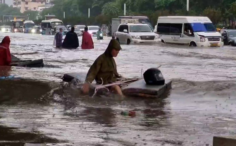
Typhoon Ha Long is unlikely to enter the East Sea and will not directly impact the mainland of Vietnam. However, northern Vietnam is suffering from floods and heavy rain. On the day and night of October 7, the Northern region and Thanh Hoa will have moderate rain, heavy rain and thunderstorms with common rainfall of 40-70mm, locally very heavy rain over 150mm; in Hanoi, Thai Nguyen, Bac Ninh, there will be heavy to very heavy rain and thunderstorms with common rainfall from 50-100mm, locally over 200mm.
Regarding the forecast of heavy rain in Hanoi, in the next 3-6 hours, the city will continue to have moderate rain, heavy rain and thunderstorms, with common rainfall of 40-70mm, locally very heavy rain over 100mm; from the evening and night, the rain will decrease rapidly.
A series of streets in Hanoi were heavily flooded during the rain on the morning of October 7.