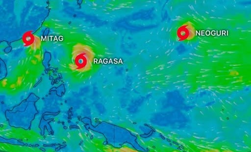
The Philippine Atmospheric, Geophysical and Astronomical Services Administration (PAGASA) is currently monitoring three storms: Typhoon Mitag, Typhoon Ragasa and Typhoon Neoguri.
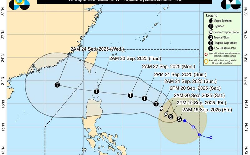
Regarding Typhoon Mitag (Typhoon No. 8 in the East Sea), on the afternoon of September 19, the storm made landfall in the southern part of Guangdong province (China) and at 4:00 a.m. on September 20, it weakened into a tropical depression in the southern part of Guangdong province.
Meanwhile, Ragasa is forecast to become the ninth typhoon in the South China Sea and the possibility of becoming a super typhoon cannot be ruled out.
According to PAGASA's typhoon forecast, on September 20, Typhoon Ragasa (called Nando in the Philippines) turned west-northwest towards the northernmost tip of Luzon. According to the forecast track, the center of Ragasa may pass near or may make landfall in the Babuyan Islands between Monday afternoon (22.9) and early Tuesday morning (23.9). The storm could leave the Philippine forecast area at noon or the afternoon of September 23 and enter the South China Sea, becoming the ninth typhoon.
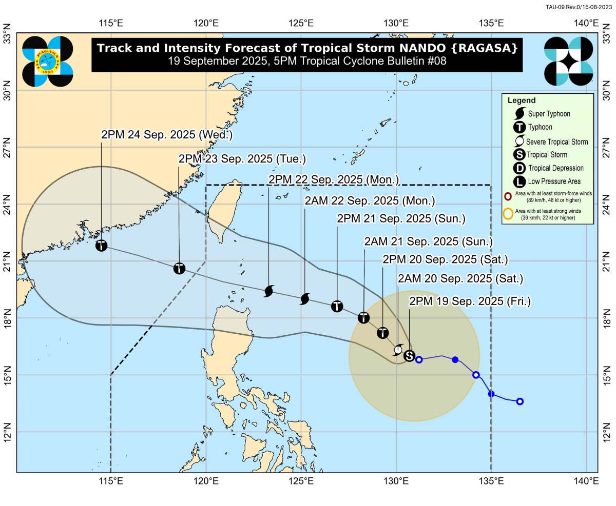
Typhoon Ragasa is forecast to continue to strengthen as it passes through the Philippine Sea. The storm could reach typhoon status today (September 20) and super typhoon status on September 22 before approaching the Babuyan Islands.
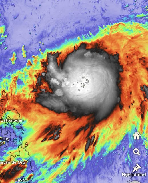
The convection process around the center of the storm is taking place extremely strongly and the intensity will continue to increase rapidly in the next 3-4 days. According to meteorological experts, this could be one of the strongest storms to hit the target in 2025 globally.
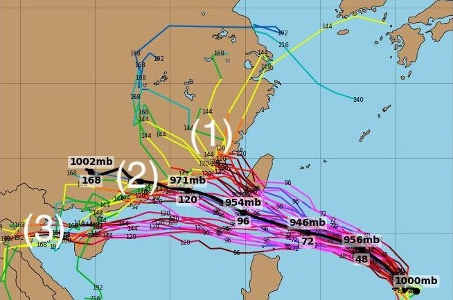
Currently, Ragasa's forecast track still has many differences between models. According to the summary of storm forecast results from 21 member models of the global weather forecast system GEFS (USA), all 3 path scenarios have shifted slightly to the North.
According to these scenarios, super typhoon Ragasa is forecast to have the strongest winds on September 22-23 at level 15, 16, gusting above level 17 - passing the current typhoon level of Vietnam.
However, some major forecasting centers believe that after entering the East Sea, storm No. 9 has begun to weaken right at sea and does not need to wait until it is close to the shore. It is forecasted that if storm No. 9 moves towards Vietnam, its level will decrease significantly.
Meanwhile, according to PAGASA, tropical storm Neoguri in the Pacific Ocean may also strengthen and is likely to reach super typhoon level, although it is still uncertain whether the storm will enter the Philippine PAR forecast area or not.
The Japan Meteorological Agency said that Typhoon Neoguri is about 2,320km east-southeast of Tokyo, Japan. The storm is moving towards eastern Japan and is expected to change direction and enter the open ocean starting on September 21.