On November 21, Mr. Vu Ngoc An - representative of the Gia Lai Provincial Civil Defense Command - said that the flood level in the area is currently decreasing, but is still concerned about the risk of flooding in low-lying areas and along rivers.
If the rainfall continues, the risk of landslides, subsidence, and flash floods will increase, affecting people's lives, lives and property.
According to the National Center for Hydro-Meteorological Forecasting, in the next 6 hours, there is a risk of flash floods, landslides, and land subsidence on steep slopes and small streams in the provinces of Gia Lai, Dak Lak, Khanh Hoa, Lam Dong.
Floods on Vu Gia - Thu Bon rivers, Tra Khuc river, Kon river, Ba river are receding.
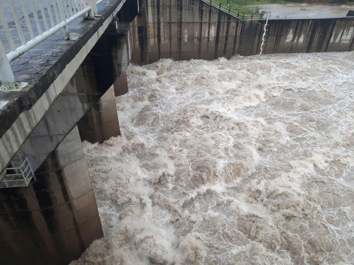
Mr. An added that to ensure the safety of reservoirs, irrigation reservoirs, and hydropower plants, flood discharge is still regulated according to regulations or discharge through spillways to bring the lake water level back to normal water levels.
The eastern area of Gia Lai province has 164 reservoirs with a capacity of more than 675 million m3, many of which are full of water and 58 lakes flowing through the spillway.
The western area of the province has 119 reservoirs (excluding Ia Mo lake managed by the Ministry of Agriculture and Environment), with a capacity of 600 million m3. As of November 20, there are 84 flooded lakes and 86 overflowing lakes.
The large lakes are regulating to bring water levels back to normal levels, with a smaller discharge than the amount of water coming in to reduce flooding in downstream areas and ensure construction safety.
Floods are still complicated, local authorities recommend that people go to safe shelters, do not travel in river and stream areas to prevent floodwaters from rising suddenly, causing isolation and isolation.


