Weather forecast for the next 24-48 hours, the continental cold high pressure will strengthen and weaken from November 5. The tropical convergence zone with an axis through the South Central - South connects with the low pressure area in the central East Sea area to gradually weaken and storm Kalmaegi in the East of the Philippines, around November 4-5, storm Kalmaegi will move into the East Sea. Above, the subtropical high pressure with an axis through the North - North Central region will gradually weaken.
Weather forecast for the next 3-10 days, the continental cold high pressure will move to the East and gradually weaken, around November 8-9, the continental cold high pressure will be strengthened and shift to the East.
The tropical convergence zone through the South Central - South connects with storm Kalmaegi moving into the East Sea to become storm No. 13, then the storm moves west and is likely to strengthen. Above, the subtropical high pressure with an axis through the North Central - Northern regions tends to lift its axis to the North.
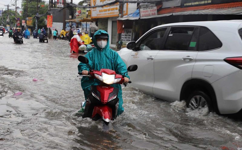
Therefore, from 1:00 p.m. on November 3 to 1:00 p.m. on November 5, Ho Chi Minh City and neighboring provinces and cities will have moderate rain, heavy rain and thunderstorms, locally very heavy rain. Total rainfall is generally 60-130 mm, in some places over 130 mm. From November 6, the rain will gradually decrease in both area and volume in the area.
Regarding high tides, the highest water level of the day at most stations on the Saigon River will continue to rise following the high tide on September 15 of the lunar calendar in the coming days. The peak tide of this period is likely to appear on November 6-7 (ie September 17-18, lunar calendar).
Phu An station and Nha Be station are at 1.70-1.75 m, 0.10-0.15 m above alert level III. Peak tides occur at 4-6am and 5-7pm. Thu Dau Mot Station is at 1.80-1.85 m, 0.20-0.25 m above alert level III.