Weather forecast for the next 24-48 hours, super typhoon Ragasa will move in the West Northwest direction into the North East Sea and become storm No. 9.
The tropical convergence zone connecting with storm No. 9 tends to gradually lift its axis to the North. The southwest monsoon is gradually getting stronger. Above, the subtropical high pressure weakens and retreats.
Weather forecast for the next 3-10 days, the tropical convergence zone with an axis through the Central region will be active, connecting with storm No. 9 in the North East Sea area. Storm No. 9 has a stable intensity and moves in the West Northwest direction towards the Gulf of Tonkin.
From around September 25, the storm will gradually decrease in intensity, then it is likely to make landfall in the southern provinces of the Northern Delta to Thanh Hoa around the night of September 25 to the early morning of September 26.
Around September 25-26, the continental high pressure in the North is likely to strengthen weakly in the mountainous areas of the North. From September 26-27, there is a possibility of a tropical convergence zone with an axis passing through the South Central region. The southwest monsoon will operate at medium to strong intensity. Above, the northern branch of the subtropical high pressure has an axis across southern China, tending to encroach on the West.
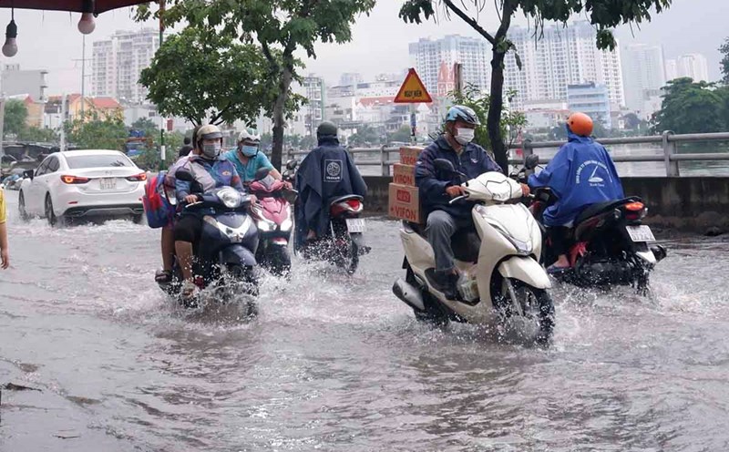
Therefore, the Southern region will have cloudy skies, disturbances in the atmosphere, causing heavy rain, gusts of wind, thunderstorms, lightning... some places will have moderate rain, locally heavy rain.
Beware of thunderstorms accompanied by dangerous weather phenomena such as tornadoes and strong gusts of wind affecting agricultural production, breaking trees, damaging houses, traffic works, and infrastructure.