According to the People's Committee of Can Tho City, the coastline from the mouth of My Thanh River to near culvert No. 14, Vinh Hai Commune (Can Tho City) has been seriously eroded in recent years. Many areas no longer have protective forests, high tides and big waves hit the dike body directly, causing landslides and broken dykes in early 2023 and late 2024, seriously affecting people's production and daily life.
Thanks to support from the Central Government, in the period of 2023 - 2024, the locality has invested in building more than 10 km of underground wave-reducing embankments, promoting the effectiveness of dyke protection, repair of alluvial areas and restoration of protective forests.
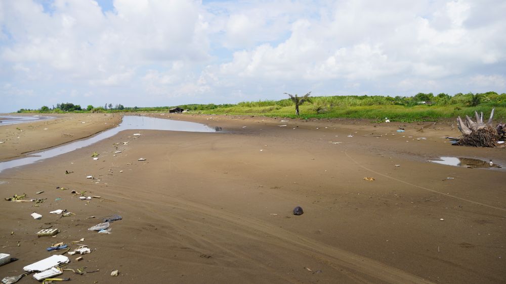
However, the section from culvert No. 13 to culvert No. 14 has not yet been invested in, causing this area to continue to be eroded during the high tide in early 2025, breaking embankments, flooding houses and affecting more than 3 hectares of crops and fish ponds. Currently, there are about 20 households living outside the dike in extremely dangerous conditions, when this area no longer has wave-breaking forests, small embankments, making it difficult to withstand high tides and strong winds.
Mr. Thach Luot, a resident living near the landslide site in Vinh Hai commune (Can Tho city), said: When the tide rises, especially during the monsoon season from November to the end of the year, waves hit the shore hard, water floods into the buffer zone for kilometers, affecting people's production.
"Once my entire watermelon growing area was flooded with salt water, and when the water receded, the melons also drifted out to sea. Many households had to move to another place because they were afraid that the waves would collapse their houses at any time. We really hope to invest in breakwater to feel secure in living and producing," said Mr. Luot.
Mr. Ly Trung Lap, Vice Chairman of Vinh Hai Commune People's Committee (Can Tho City) said that coastal sections with breakwaters have been effective, helping to preserve production soil, reduce erosion and create conditions for mangrove forests to recover. However, there are still about 3 km that have not been invested in, often hit directly by sea waves, causing erosion of the area outside the dike, greatly affecting people's lives.
"The locality hopes that the State will invest in the remaining embankment to protect the safety of the coast, production buffer zone outside the dike and the sea dike inside," said Mr. Lap.
The leader of Vinh Hai Commune People's Committee also said that the locality plans to plant protective forests from the sea to the area of the breakwater to contribute to preventing erosion.
Similarly, the area from the border of Ca Mau province to culvert No. 4 (Lai Hoa commune, Can Tho city) is also experiencing landslides with a total length of about 7km. Many sections no longer have protective forests, waves hit the foot of the dike directly, seriously threatening the safety of the dike and people's livelihoods. People are concerned that if high tides combined with strong winds and big waves continue to last, the risk of dike breaches is very high, leading to deep salinity intrusion, seriously affecting production.
According to the Can Tho City Irrigation Department, the whole city has a 72km long coastline; of which, the sea dike section from the border of Ca Mau province to Tra Nien canal is about 56km long (compared to the 50km coastline in the old Vinh Chau area), the width of the dike surface is from 6 - 7.5m. Recently, thanks to capital from landslide recovery projects, many sections of wave-reducing embankments have been built, contributing to protecting the sea dike system and coastal residential areas.
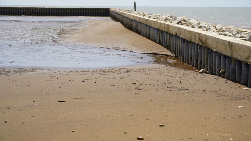
However, areas that have not been invested in are still strongly affected by sea waves, posing a potential risk of serious landslides. Currently, the section from the border of Ca Mau province to culvert No. 4 has completed 4.2km of underground embankment, and about 2.8km is being proposed for investment support by the Ministry of Agriculture and Environment. The area from culvert No. 14 to the mouth of My Thanh River has been built for more than 10km, but it is still necessary to continue to invest in about 2.4km more to protect the entire coastline.
On October 9, the People's Committee of Can Tho City issued a Decision to declare an emergency situation regarding natural disasters related to coastal erosion in the area from culvert No. 13 to culvert No. 14, Vinh Hai Commune. Assign the Department of Agriculture and Environment to closely monitor the situation, deploy temporary reinforcement measures, prevent saltwater and high tides from entering, and propose long-term solutions. The People's Committee of Vinh Hai commune is required to put up warning signs, propagate and mobilize people to evacuate from dangerous areas.