Land and forests are swept away by the sea
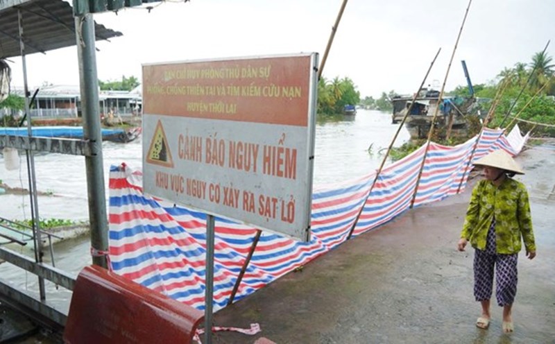
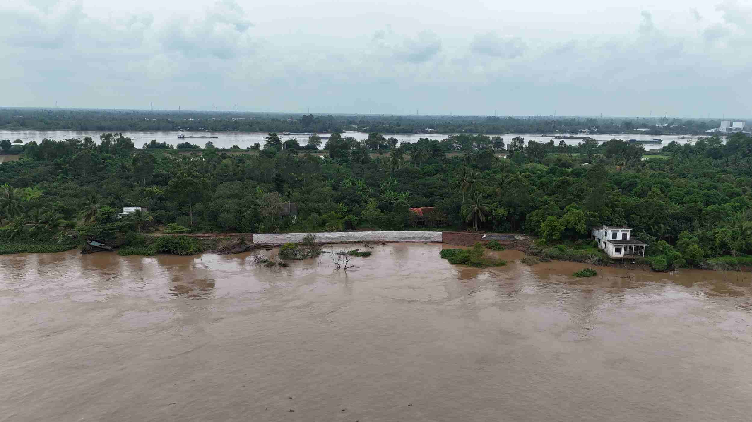
Recorded on the coastline from the mouth of My Thanh River to near culvert No. 14, Vinh Hai Commune (Can Tho City), many areas have no protective forests, high tides and big waves hit the dike body directly, causing landslides and dike breaks in early 2023 and the end of 2024, severely affecting production and people's lives. Similarly, the area from the border of Ca Mau province to culvert No. 4 (Lai Hoa commune, Can Tho city) is also experiencing landslides with a total length of about 7km. People living near this area expressed concern that if the high tide combined with strong winds and big waves continues to last, the risk of dike breaches is very high, leading to deep salinity intrusion, seriously affecting production.
In Ca Mau, nearly 100km along the East coast have been seriously eroded. Each piece of cultivated land, each house, and shrimp squares were swept away by the waves. Many households are forced to move their houses deep inland or move around in constant anxiety.
Ms. Tran Thi Cuong (Cho Thu B Hamlet, Tan An Commune) is one of them. Over the past 10 years, she has had to move her house twice because of land encroachment. "In front of my house, there were nearly 6 hectares of shrimp farming land, now out of stock. The sea is only more than 100m from home. I must have considered the third relocation" - Ms. Cuong said sadly.
During the 2024 monsoon season, the water suddenly rose more than 2m, sweeping away everything. No more land, no more jobs, currently the whole family of Mr. Teo (Tan An commune) can only cling to the sea to survive. "Every night I have a life jacket ready next to my bed, afraid that the waves will suddenly hit me..." - Mr. To sadly, his eyes full of anxiety looking out to the sea.
Ca Mau currently has a coastline of more than 310km long, of which more than 200km is experiencing landslides at different levels. The danger level alone accounts for more than 80km, including about 61km on the East Sea coast and 22km on the West Sea coast. According to Head of the Department of Irrigation of Ca Mau province, Nguyen Thanh Tung, from 1990 to 2023, coastal landslides have lost more than 8,800 hectares of land and protective forests, an average of more than 25 hectares per year.
Hoang Vong along the Mekong River
Not only the coast is eroded but on the Mekong River branches, this situation occurs in many localities, threatening houses, fruit gardens and the daily lives of people.
In Quoi Thien commune (Vinh Long province), the family of Ms. Le Thi Dong, 56 years old, is one of the households that had to be urgently evacuated. Her house was under direct threat, forcing the family to temporarily stay at her father-in-law's house. Her 96-year-old mother had to return to live with her brother on the mainland. The roofs are empty, the gardens are flooded, the rivers are gradually swallowing up the soil, causing anxiety to cover the lives of people in Con Thanh Long. "We have to move our belongings and assets constantly because we are afraid that our house will be swept away. The children have to be sent to another place, making daily activities extremely difficult" - Ms. Dong added.
In the same situation, Ms. Ta Thi Ro - a resident of Thanh Long Islet - sadly said that she and her husband lived alone and had no children, so everything was handled by themselves. Since the beginning of 2020, when the riverbank began to erode strongly, the couple had to temporarily build a small hut on the neighbor's land to avoid danger. Every time there is a landslide, water floods grapefruit and coconut gardens, causing about 50% of the trees to die, while the remaining trees also produce very low productivity. In the past, each harvest was enough to survive, now the fruit trees are gone, the garden is eaten by water every meter. The elderly couple could only look at each other in fear, not daring to sleep at ease for fear of a landslide that would suddenly happen" - Ms. Ro shared.
Meanwhile, in the locality at the headwaters of the Mekong River, Dong Thap, from August to now, there have been a series of riverbank landslides. According to the Irrigation Department of Dong Thap province, from the beginning of the year to August 30, 2025, there have been 7 landslides on the Tien River, including 1 serious incident at Thuong Thoi Tien embankment (Thuong Phuoc commune). In addition, there were 100 landslides in the fields and subsidence with a total length of more than 14.9km, collapsing 1 house.
Most recently, on September 20 and September 24, due to the impact of heavy rain, rapid flooding combined with a large number of waterway vehicles, in Cao Lanh ward, there were 2 landslides on the Tien River bank in Group 1, Tan Tich Hamlet and Tinh Hung Hamlet, Cao Lanh Ward. The emergency and dangerous landslide was about 500m long, eating about 30 - 70m inland, causing no human casualties but property damage to 35 households with 132 people whose houses and land had sunk into the river. The remaining section, about 1,600m long, is at risk of landslides at any time, affecting the safety of life and property of about 285 households with over 900 people.
It is necessary to soon invest in a synchronous breakwater system
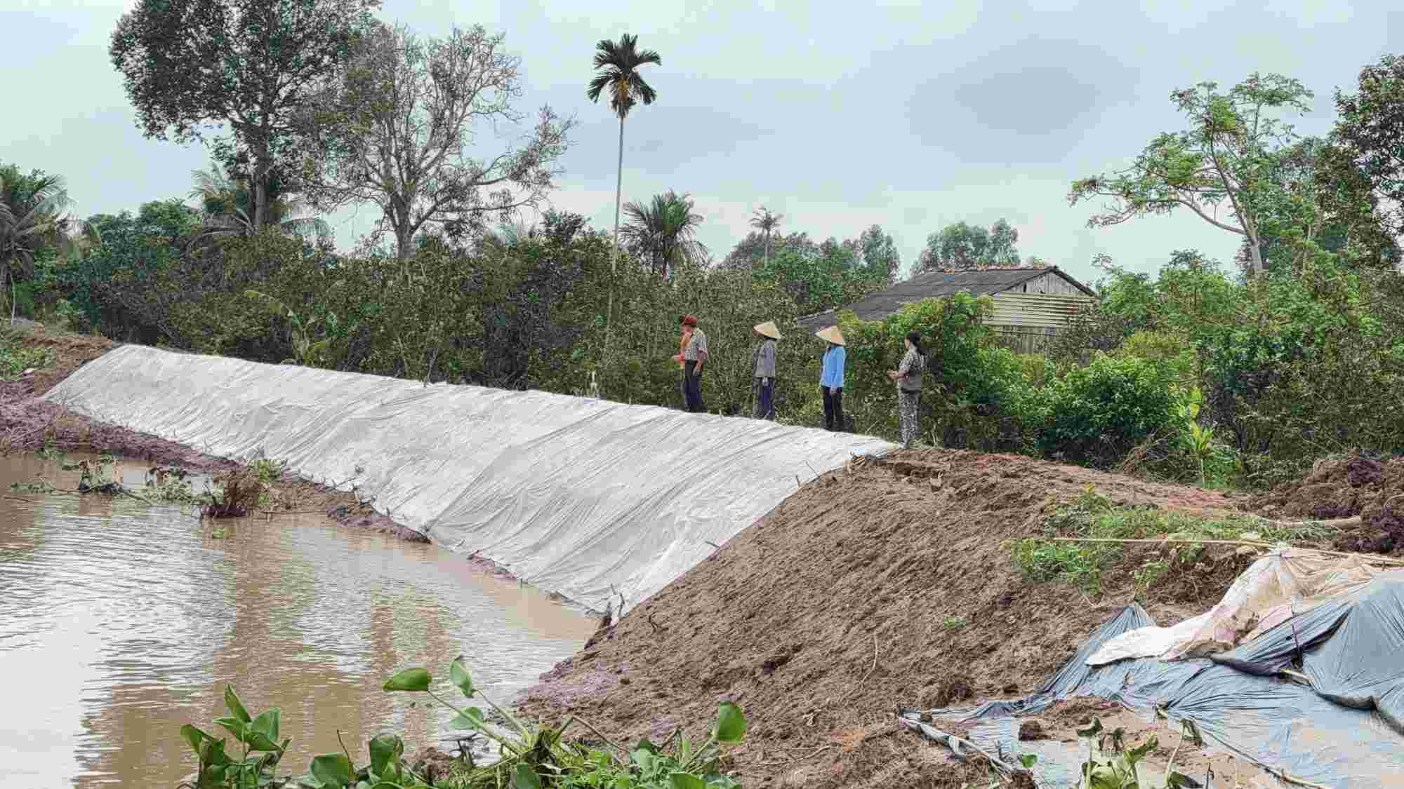
Thanks to support from the Central Government, in the period of 2023 - 2024, Soc Trang province (now Can Tho city) has invested in building more than 10km of underground wave-reducing embankments, promoting the effectiveness of dyke protection, repair of alluvial plains and protective forests. However, the section from culvert No. 13 to culvert No. 14 has not yet been invested in, causing this area to continue to be eroded during the high tide in early 2025. Mr. Ly Trung Lap - Vice Chairman of Vinh Hai Commune People's Committee (Can Tho City) - said that coastal sections with breakwaters have been effective, helping to keep production soil, reduce erosion and create conditions for mangrove forests to recover. However, there are still about 3km that have not been invested in, often hit directly by waves, causing erosion of the area outside the dike, greatly affecting people's lives.
In Ca Mau, in recent years, the province has mobilized many capital sources from the central, local and international loans to build landslide prevention and control works. To date, more than 111km of coastal anti-landslide embankments have been completed with a total cost of more than VND4,848 billion. Of which, the West Sea bank alone has completed more than 56km of embankment, the rest belongs to the East Sea bank and the mouth of the Ganh Hao river. These projects have demonstrated their effectiveness, reducing waves, limiting landslides and initially creating alluvium, restoring nearly 1,000 hectares of protective forests. Many coastal residential areas have been rearranged, helping people stabilize their lives.
Vice Chairman of Ca Mau Provincial People's Committee Le Van Su said that the fundamental solution of the province is to complete the entire system of dykes and embankments along the coast, the most important of which is the 138km long East Sea dykes (from Canal 5 Rach Cheo to Ganh Hao Gate) and the remaining 22km of dykes along the West Sea, combined with the construction of traffic roads on the dykes to create momentum for economic development in coastal areas.
In Vinh Long province, the leader of the Provincial Agricultural Project Management Board said that to protect the more than 42km long sea dike, the locality needs more than 22.6km of embankment, but has not yet arranged capital. Some uninvested sections have experienced landslides, affecting people's production and daily life.
According to the Can Tho City Irrigation Department, the section from the border bordering Ca Mau province to culvert No. 4 has been completed with 4.2km of underground embankment, and about 2.8km is being proposed for investment support by the Ministry of Agriculture and Environment. The area from culvert No. 14 to the mouth of My Thanh River has been built for more than 10km, but it is still necessary to continue to invest in about 2.4km more to protect the entire coastline.
Ca Mau is currently developing a comprehensive project to prevent landslides, subsidence and saline intrusion with a total capital demand for the period of 2026 - 2030 of up to 35,000 billion VND, currently waiting for the Ministry of Agriculture and Environment to synthesize it into the Project to prevent and combat subsidence, landslides, flooding, drought and saline intrusion in the Mekong Delta with a vision to 2050.
* The People's Committee of Vinh Long province has assigned the Department of Agriculture and Environment to preside over and coordinate with relevant units to advise the Central Government to consider supporting investment in the construction of a sea dyke and implementing an emergency resettlement project in this area to ensure the safety of the people. For the Giong Ban sea dike (Giong Ban hamlet, Long Vinh commune) that collapsed with a length of about 410m, the Provincial People's Committee plans to allocate 16 billion VND to fix the problem from the provincial budget.
* According to the Can Tho City Irrigation Department, in recent times, from the capital of coastal landslide recovery projects, many sections of wave-reducing embankments have been built, contributing to protecting the sea dike system and coastal residential areas. However, areas that have not been invested in are still strongly affected by sea waves, posing a potential risk of serious landslides.