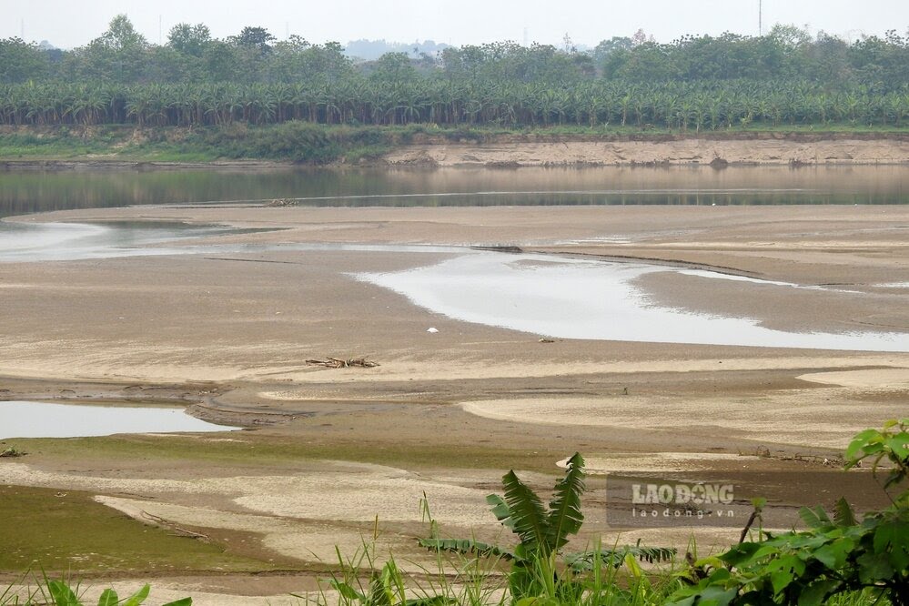
As Lao Dong has reported in many articles, in the first months of 2025, the water level of the Thao River (Red River) passing through the old Yen Bai province (now Lao Cai) and Phu Tho province is exposed, on the river there are many alluvial plains, giant sand dunes, some places that can be walked across the river.
For example, in April 2025, the actual water level of the Red River measured at Phu Tho station is on average 10.95m, the highest is 11.61m, the lowest is 10.35m...
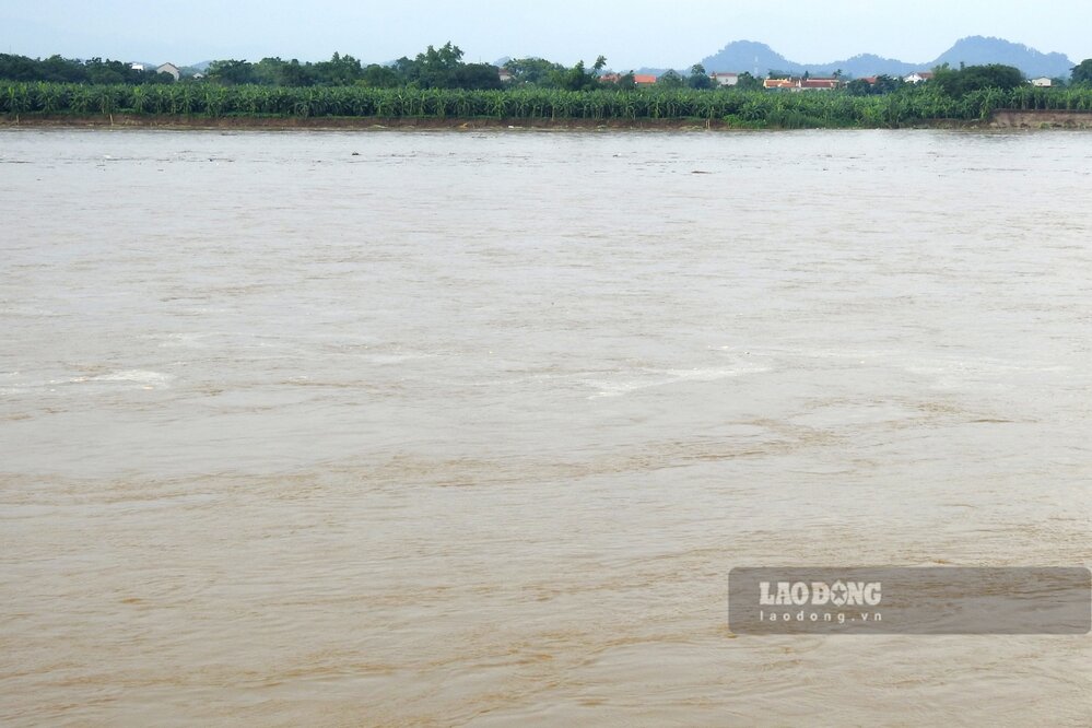
However, during the flood season, the Thao River section passing through Lao Cai and Phu Tho provinces has changed a lot, the large sand dunes and alluvial plains in the middle of the river are no longer present on the river like in the dry season just a few months ago.
According to the National Center for Hydro-Meteorological Forecasting, in July, on rivers in the Northern region, there were 3 concentrated floods from June 30 to July 3, from July 11 to 13 and from July 23 to 24.
Phase 1 (from June 30 to July 3), on the rivers: Thao River, Lo, Gam, Cau and some small rivers in the Northern region, a flood with a flood amplitude at stations from 1.5m - 5.0m appeared. During this flood, the peak flood level at upstream stations of Thao, Lo, Gam rivers and some small rivers and streams reached alert level 1 - alert level 2, the flood peak on other rivers was below alert level 1.
In the second phase (from September 11 to 13), a small flood appeared on the Thao River with flood amplities at stations from 1.5m - 2.0m. During this flood, the peak water level at stations on the Thao River is below alert level 1.
Phase 3 (from July 23 to 24), downstream of the sports river at Yen Bai station, there was a flood with a flood amplitude of up to 3m, the flood peak of Thao river at Yen Bai station was below alert level 1.
In the first half of August, water levels on the upstream of the Northern rivers have changed little...
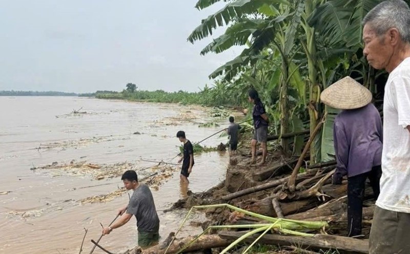
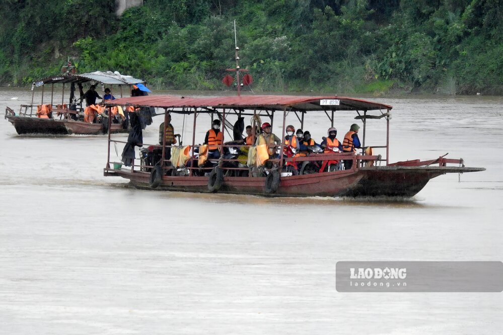
According to Lao Dong Newspaper reporters on August 21, when the water level of the Thao River section passing through Phu Tho province has risen quite high, the ferry terminals across the river operate more effectively when there is no need to change the location of the wharf, or have to go around due to sand and alcohol in the dry season.
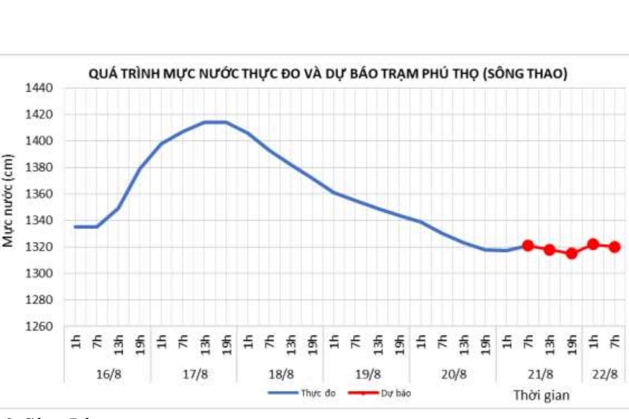
According to the National Center for Hydro-Meteorological Forecasting, on August 21, on the Thao River, the water level at Yen Bai station and Phu Tho station changed slowly.
The actual water level measured on Thao River at Yen Bai station at 7:00 p.m. on August 20 was 25.97 m, at 7:00 a.m. on August 21 it was 26.17 m, forecast to reach 26.05 m by 7:00 p.m. on the same day. At Phu Tho station, the actual water level measured at 7:00 p.m. on August 20 was 13.18m, at 7:00 a.m. on August 21 was 13.21m, and is forecast to reach 13.15m by 7:00 p.m. the same day.
However, the slow change in the water level of the Thao River will not last long, because according to the forecast, from now until the end of September 2025, there is a possibility of 2-3 floods on the main rivers in the North, the peak flood water level on the main rivers in the Northern region will be at alert level 1 to alert level 2...
It is forecasted that in September 2025, the actual water level measured on the Thao River at Yen Bai station will be about 27.50m on average, the lowest will be 26.00m, the highest will be 31.00m; at Phu Tho station, the water level is forecast to be about 13.80m, the lowest will be 12.50m, the highest will be 16.00m.