From those working in meteorological agencies, to the storm reporter and the on-site reporter who directly crashed into the center of Typhoon Yagi, we all understand that in the storm, accurate information is life. I learned that not in class, but in each storm season I have gone through. Therefore, we did not dare to sleep when the eye of the storm was "still warm".
Source of information, bridge from the center of the storm
When the first news about Typhoon Yagi appeared, few people knew that behind the proactiveness of the press was the quiet but persistent connection of those working in communication at meteorological agencies. Among them, Ms. Hoang Thi Hoai Linh - an officer of the Department of Hydrometeorology - is considered a special bridge between experts and the press. We weather reporters always affectionately call Ms. Linh a "special reporter" right in the heart of the meteorological agency.
20 years of working in hydrometeorological communication activities with the responsibility of giving the earliest warning to the community, she has never felt as shy as when watching the fierce whirlwinds of Typhoon Yagi.
"I always remember the feeling at that time, the feeling of small people being helpless in the face of natural disasters. Because I have never felt such a strong storm in all my years in the profession" - Ms. Linh recalled.
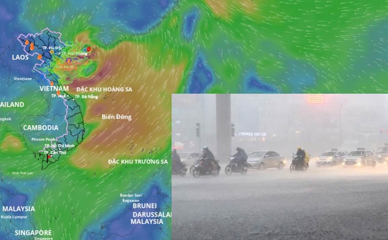
At 0:00 on September 7, 2024, when international forecasts and social networks were widely reported that the storm had weakened after passing through Hainan Island, the Vietnam Meteorological Agency still did not lower the storm level.
"At that time, my phone rang repeatedly, calls and messages were suspicious and questionable. But forecasters at each location remain steadfast in their forecast, that storms entering the Gulf of Tonkin will strengthen rather than weaken. And that was the case. Every time the natural disaster season passes, we have to go through different levels because storms and floods seem to no longer follow any rules" - Ms. Linh said.
Every time the storm has changes, Ms. Linh prepares for meetings to exchange information with the press, fully conveying the messages of forecasts and warnings about natural disasters.
"The characteristics of the forecast are the science of probability, while the weather and climate characteristics of Vietnam are highly volatile, so the best way is to continuously update so that information is not missed. For example, during Typhoon Yagi in 2024, there were 24 times I provided information to reporters on a peak day" - Ms. Hoai Linh recounted.
A timely warning can save many lives
For 8 years as a reporter specializing in the field of Hydrometeorology, I was the one who received the "first source" information from Ms. Hoai Linh and turned them into press reports reaching millions of readers. At the same time, I also provided early information about the localities affected by super typhoon Yagi so that the leadership of the newsroom could focus on the "first phase".
Since super typhoon No. 3 Yagi intensified, I have been on duty almost day and night at the Center for Hydrometeorological Operations. I call this place the day loan heart of the storm season. In that room, the figures of pressure, wind speed, rainfall... are not simply data but are vital instructions for millions of people. Each forecast and warning issued from here will decide how many ships will be able to return to shore, how many households will have to be urgently evacuated.
Working here, I do not run in the wind of storms, but I race between newsletters, running with each update data. Typhoon Yagi continuously intensified, when there was a forecast that the center of the storm was heading towards Quang Ninh - Hai Phong, I wrote and pushed away an important report in just minutes. Each newsletter that is broadcast needs to carefully review each wind supply detail, coordinates, and scope of influence. If a word is wrong, a number is wrong, people can act wrongly. That is the pressure but also the motivation for me to be accurate to the end.
Because I understand that in storms, accurate information is life. I couldn't learn that in class, but in each storm season I went through.
Reporters in the midst of the tornado - those who "touched" the storm
Hai Phong is forecast to be the locality that will suffer the first impacts of Typhoon Yagi on land.On the morning of September 6, 2024, under the direction of the news agency, reporter To The was present in the Do Son sea area.To be able to directly record the entire scene of the storm making landfall, a group of reporters rented a hotel just about 50m from the coast.
At 9:00 a.m.on September 7, the wind began to beat strongly, with pouring rain, each wind shifting from the mainland towards the sea - a sign that the storm center is approaching the mainland.Under the pouring rain and strong gusts of wind, To The led the scene right to Do Son beach area.
At 2:00 p.m. the same day - the time I will not forget during this business trip, the entire hotel where our group of reporters were staying started to shake violently, many pieces of glass were broken and fell down to the floor. Although the center of the storm has not yet entered, the scene is already chaotic" - To The recalled.
During the historic storm days, To The's backpack was always ready with drinking water, instant noodles, medicine, backup chargers and at least two SIM cards of the two network operators - survival items in storms and floods.
Going through the storm with enthusiasm and persistent labor, To The learned the biggest lesson not only the flexibility of work, but also the limit of commitment.
"I have and will continue to journey to the center of the storm, not afraid of hardship and difficulties. But after many natural disaster seasons, I think don't trade your safety and that of others for just a beautiful frame - especially during a storm" - To The shared.
When his colleagues took turns going to hot spots in the eye of the storm, Hoang Xuyen, even a female reporter, was also a volunteer in the storm in Hanoi. This city - where super typhoon Yagi left its mark with continuous gusts of wind and heavy rain.
The storm hit Hanoi, Xuyen and her colleagues still did not leave the scene. In those days, the female reporter wade in the rain and wind, clinging to each deeply flooded street, recording every film and frame in the middle of the vast ocean of water reaching her waist.
In Xuyen's memory, those are days filled with anxiety but also filled with enthusiasm to record the truth - the moments when people struggle with natural disasters.
"The most memorable time was the time I took a boat across the Red River to the middle of the beach. Even though I was wearing a life jacket and accompanied by authorities, I was still nervous because I was afraid. The biggest concern is the broken camera and equipment. But I understand that there must be this image so that readers understand the helplessness of people when the water floods" - Xuyen said.
Xuyen never forgets the bewildered eyes of a woman burst into tears because she could not take her her herd away from the flood; does not forget the scene of people hopelessly raising their belongings, trees lying around, bananas falling down, and the whole area was flooded with white water.
That image choked me up. At that time, I was no longer just a businessman, but a witness and a person who felt sorry for the hardships of my compatriots in the storm. I chose to go in the eye of the storm to tell the lives of people in natural disasters with all my sympathy.
The blurred photos of the water, the scenes filmed in a hurry in the wind - are not only professional documents, but also living proof of the spirit of adherence of journalists, ready to commit in the heart of the storm.