Recently, many unusual natural disasters have occurred. Mr. Mai Van Khiem - Director of the National Center for Hydro-Meteorological Forecasting assessed this situation and the application of science and technology to improve the quality of forecasting and warning in the current context.
Sir, could you please tell us how unusual the recent natural disasters have been?
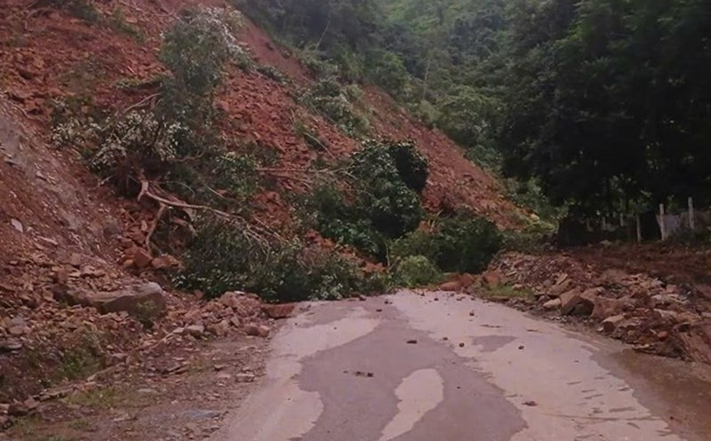
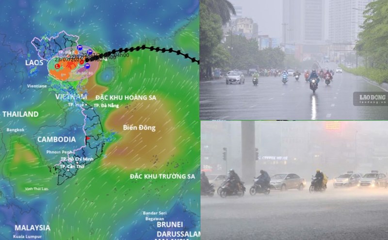
- Previously, there were record rains of only a few dozen mm, but now the rains can reach 100 - 200 mm. These are previously unrecorded rainfall and are now appearing more and more. Record records for temperature, rainfall, and strong winds have also been continuously broken in recent years. These are things we have witnessed such as natural disasters, heavy rain, major floods in 2020, the great storm Yagi in 2024.
Natural disasters are one of the great dangers that can greatly impact socio-economic activities, causing damage to people and property. In 2020, there were 42 consecutive days of continuous rain and wind in the Central provinces and in 2024, Typhoon Yagi caused a lot of damage to people and property.
To minimize damage caused by natural disasters, forecasting is extremely important. How many days can you warn about all types of natural disasters in advance?
- Forecasting plays a very important role, as a source of input information for directing and responding to natural disasters. However, natural disasters are very unusual and change very quickly. Therefore, the forecast problem always has to be updated continuously and regularly.
For some types of natural disasters, we can forecast early; such as droughts can be forecasted several months in advance. However, for extreme and short-lived natural disasters such as storms and tropical depressions, we can forecast 3 days in advance and warn 5 days in advance.
Types of natural disasters that appear very quickly such as flash floods, landslides, tornadoes, and tornadoes can appear in a few dozen minutes and can dissipate quickly within a few dozen minutes to 1 hour. We only warn about those phenomena and cannot predict them.
How has the application of science and technology and scientific works been applied to forecasting in the past, sir?
- The hydrometeorology industry is a science and technology industry, so the application of science and technology is an extremely important key to helping us gradually approach the world's forecasting level.
In recent years, every year, the Ministry of Agriculture and Environment has also implemented a number of research topics at the ministerial level, including basic research on interaction issues, atmospheric physics, methods and tools to support forecasting and warning work.
In addition, the Ministry of Science and Technology is implementing a number of state-level research topics on developing research methods on heavy rain and storm forecasting.
These studies help build methods and tools to predict natural disasters such as heavy rain, storms, and flooding. Those research results have also been exploited and used in the daily meteorological warning forecast work of the National Hydrometeorological Forecasting Agency.
What is the obvious progress of forecasting technology from the application of those scientific works, sir?
- Compared to before, we could only forecast storms within 24 hours, now we can increase the forecast period to 3 days, warning 5 days in advance. That is one of the clear advances.
For drought in the Mekong Delta, we did not have long-term forecasting tools before, now we have tools to forecast drought from 3 months to 6 months.
It can be seen that the application of satellite monitoring technology, multi- Solve monitoring, and automatic rain stations used to be less frequent, but now we have more detailed data to help make more specific forecasts and warnings.
Sincerely thank you!