The latest storm information on the morning of August 9 from the Philippine Atmospheric, Geophysical and Astronomical Services Administration (PAGASA) said that Typhoon Podul is expected to enter the Philippine Forecast Area (PAR) as Tropical Depression Fabian moves deep into the East Sea.
At 8:00 a.m. on August 9, tropical depression Fabian weakened and was located 460 km west of Calayan, Philippines. The low pressure in the East Sea is forecast to continue moving slowly west-northwest on August 9.
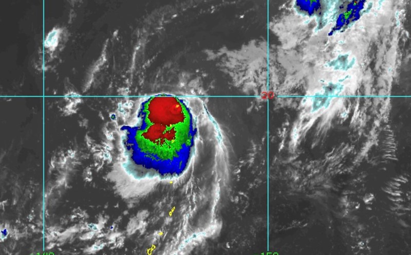
In addition to the low pressure in the East Sea, PAGASA is also monitoring the storm near the East Podul.
Typhoon Podul is expected to enter PAR on August 10 or 11 and is named Gorio in the Philippines.
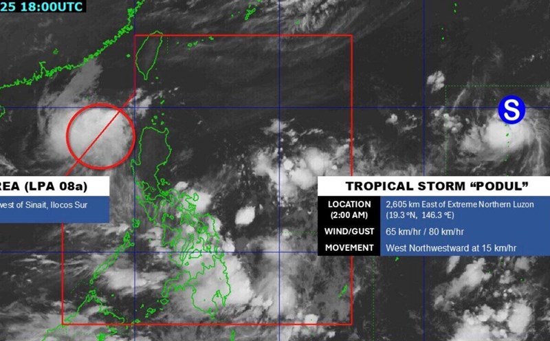
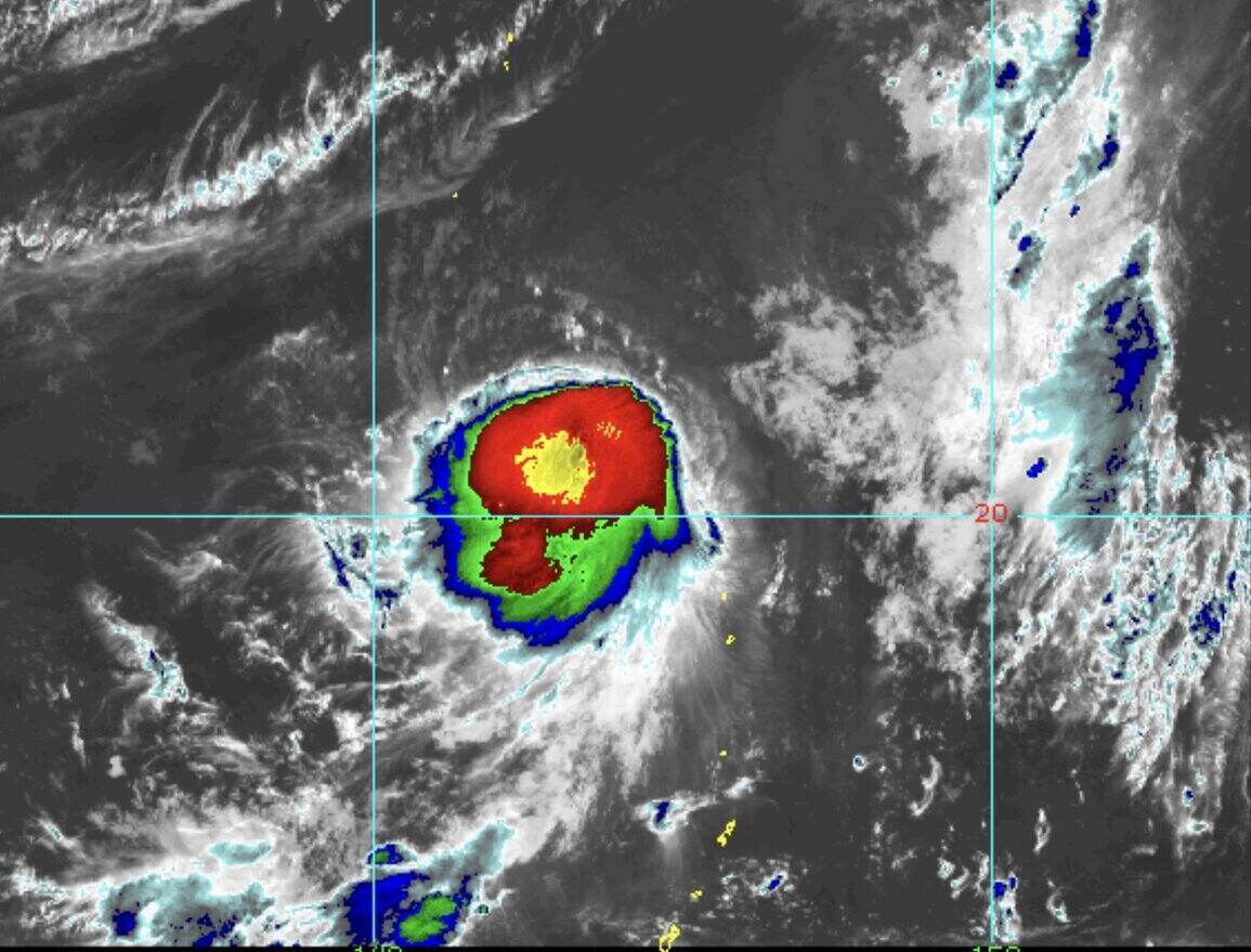
On the morning of August 9, Typhoon Podul was 2,175km from Northern Luzon, Philippines. The storm is moving west-northwest, with maximum sustained winds of 95 km/h and gusts of up to 115 km/h.
Philippine typhoon forecasters said Typhoon Podul is expected to move mainly west-northwest on August 9, then move west from August 10 to August 12 and then turn west-northwest.
"According to the forecast track, Typhoon Podul may enter PAR from the evening of August 10 to the early morning of August 11," PAGASA's typhoon bulletin stated.
The storm near the East Sea is forecast to gradually strengthen, possibly reaching severe tropical storm level from the afternoon of August 9 and then strengthen into a typhoon on August 10.
"Currently, the storm has not affected any area in the Philippines. However, the storm will continue to strengthen. Before entering PAR, Podul is likely to strengthen into a typhoon," warned PAGASA weather expert Grace Castaneda.
Also in the typhoon bulletin, PAGASA stated: "There is great uncertainty about the expected path and intensity of Typhoon Podul from August 11 to 13. Any change in the north or south direction will significantly change the forecast intensity of the storm from August 11 to August 14".
The latest typhoon information from the China Meteorological Administration (CWA) said that the path of typhoon Podul will depend on the intensity of an high pressure in the Pacific Ocean.
Accordingly, if the pressure is stronger, it will push Podul westward through the Strait of Sichuan, connecting the East Sea and the Philippine Sea, while the weaker pressure can push the storm north, affecting Taiwan (China).
If Podul moves north, the storm could weaken due to unfavorable weather conditions while its path west could strengthen.
It is forecasted that from August 13 to August 14, Typhoon Podul or the outer circulation of the storm may cause rain to many locations in Taiwan (China).