The latest storm information on the afternoon of August 8 from the Philippine Atmospheric, Geophysical and Astronomical Services Administration (PAGASA) said that the newly formed typhoon Podul may enter the Philippine Forecast Area (PAR) on August 10 or August 11.
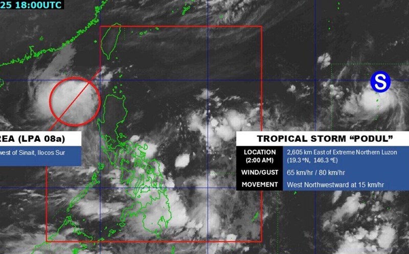
PAGASA weather expert Loriedin de la Cruz-Galicia said that Typhoon Podul was last recorded 2,580km east of northern Luzon, Philippines.
Although still far from land, the storm is forecast to move towards PAR. "Based on our latest analysis and forecast, there is a possibility of the storm entering PAR on August 10 or 11," she said.
"It is possible that before or at the time of entering the Philippine forecast area, this system has strengthened into a major storm. Podul is currently a tropical storm, but it could continue to strengthen in the coming days," she added.
Typhoon Podul currently has maximum sustained winds of 65 km/h near the center and gusts of up to 80 km/h, moving west-northwest at 15 km/h. Although it has not yet directly affected the Philippines, forecaster De la Cruz-Galicia noted that Typhoon Podul could affect the northernmost part of Luzon in the coming days.
PAGASA's latest storm forecast on August 8 stated that during the forecast period until August 21, Typhoon Podul is expected to cause continuous impacts.
Accordingly, it is forecasted that from August 8 to August 14, Typhoon Podul will enter PAR and approach Northern Luzon. This week, the typhoon will continue to move westward, entering the South China Sea, from August 15 to August 21.
In addition to Typhoon Podul, PAGASA is also monitoring the tropical depression in the East Sea. The system is expected to be named Fabian and will soon leave the PAR forecast area this week.
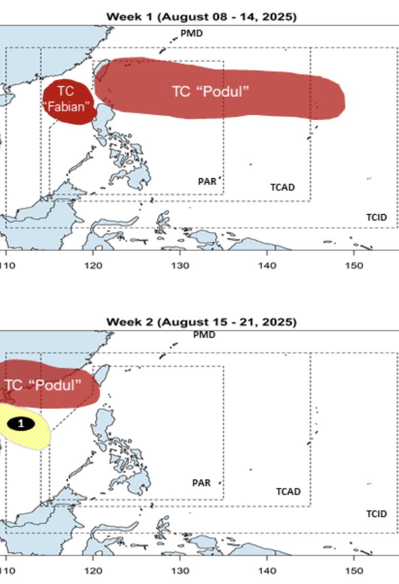
Another low pressure is likely to form in the middle of the East Sea between August 15 and August 21. Philippine forecasters say that this low pressure in the East Sea is unlikely to strengthen into a storm or tropical depression.
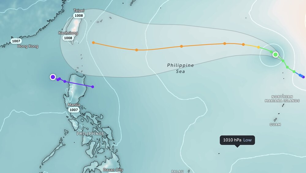
The China Meteorological Administration (CWA) said in its bulletin on August 8 that Typhoon Podul has formed in the northern sea - northeast of Guam and is expected to enter the sea southeast of Taiwan (China) next week.
The CWA said Podul is the 11th Pacific typhoon of 2025. Typhoon Podul is forecast to move westward and may have the most significant impact on Taiwan (China) on August 13 and 14.
CWA weather forecaster Tseng Chao-cheng said the typhoon is expected to become active in the sea southeast of Taiwan (China) on August 12, causing rain in eastern areas of the island until the end of August 14.