In mid-July 2025, the left bank of the Thao River through Xuan Huy Commune, the old Lam Thao District (now Lam Thao Commune, Phu Tho Province) suffered a serious landslide. The length of the landslide is about 1.2km, with an average width of 40m.
The section from Km72+800 to Km73+100 is particularly serious. The landslide was about 60m deep in the alluvial area, close to the foot of the embankment, only about 8 - 10m from the top of the embankment... causing many areas of alluvial land along the river and crops to be lost, threatening the safety of people's lives and property.
By early September 2025, the right bank of the Thao River through Huong Non Commune, the old Tam Nong District (now Tam Nong Commune, Phu Tho Province) also experienced landslides.
For many days, the area between Huong Non and the section Km72+400 to Km73+300 has been continuously eroded, eroding from 5 - 14m deep, washing away more than 15 hectares of cropland. Particularly at the section Km73+100 to Km73+300, the landslide approached the residential area, directly affecting house number 81, area 12 (now relocated).
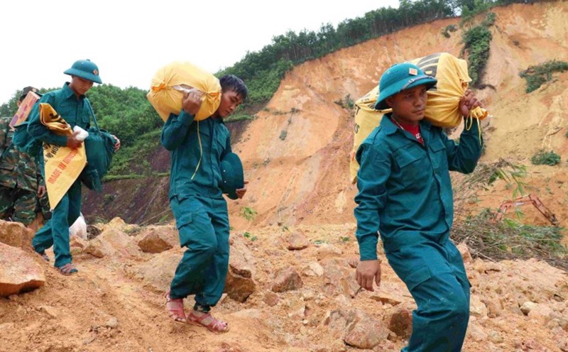
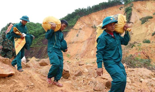
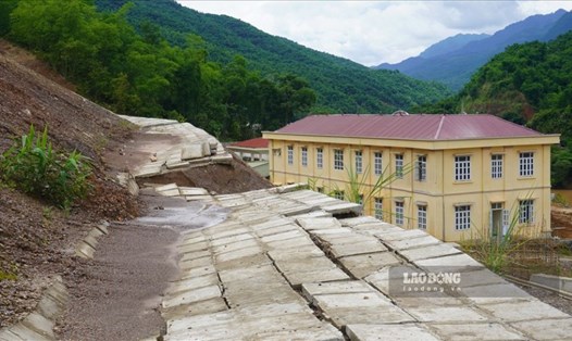
Immediately afterwards, the Department of Agriculture and Environment of Phu Tho province implemented a landslide treatment project with a total investment of 7.5 billion VND. The embankment project with loose rock holes to create anti-landslide anti-pressure mechanism has been implemented since then.
Currently, the right bank of the Red River continues to occur. According to the reporter of Lao Dong Newspaper in late October, the corresponding bank and riverbed section from Km53 - Km54+300 in Hien Quan commune is experiencing strong landslides, the length of the landslide section is about 1.3km, locally there are landslides to the side of the construction and the fence of households.
In particular, in the area of Vuc Long Pagoda and Dinh Vuc Truong (a provincial historical relic), landslides have occurred in the pagoda yard, some cracks have appeared; some areas of land, architectural objects, trees, and crops in the area were swept away; directly threatening over 50 households, affecting the safety of the right dike of Thao River (at the same time, Provincial Road 315)...
In addition, the section Km71+300 - Km72+300 in Tam Nong commune is also landslides with a length of about 1km. In the landslide area, many long cracks appeared, directly affecting residential areas No. 9 and No. 10 of Tam Nong commune with over 500 households living outside the dike, historical relic site and memorial site of Huu Ha village martyrs, cultural house and community activity of people in Zone 9 and Zone 10; The nearest landslide location is only 2 - 3m from the residential concrete road, about 10m from the cultural house of Zone 9.
In response to the above developments, the People's Committee of Phu Tho province has declared a natural disaster emergency for the incident of riverbank erosion and river covering in the two above-mentioned sections. Assign the People's Committees of Hien Quan and Tam Nong communes to coordinate with relevant agencies and units to focus on implementing a number of key and urgent tasks to respond to and prevent incidents.
At the same time, the Department of Agriculture and Environment was assigned to study and survey to complete the procedures to implement the project of investment in construction works according to the emergency order to promptly prevent incidents to ensure standards, norms, norms, and construction planning; ensure the quality of construction works, in accordance with local terrain, geology, and available materials, and save the maximum State budget.
Relevant agencies and units coordinate to carry out procedures to start construction, strive to complete the project as soon as possible, ensure technical and aesthetic quality of the project; protect the safety of the dike project, meet the requirements of flood prevention...