Landslides are no longer seasonal
According to the Department of Irrigation of Ca Mau province, there are currently many dangerous landslides, directly threatening people's lives, transport infrastructure, protective forests and trade of the people.
In the old Ca Mau area, many riverside and coastal locations are being severely eroded. For example, Sa Pho hamlet (Dat Moi commune), about 700m along Cua Lon river, is at risk of serious landslides. The Bo De estuary (Tam Giang Commune) has been eroded by 200m, damaging traffic routes and threatening the aquaculture area of the people, the total length of the danger zone is up to 750m.
In Bac Lieu province (old), now in Ca Mau province, the risk of landslides exists in many key locations. The section of the canal west of the downstream of Nha Mat culvert (Nha Mat ward) and east of Cay Gua culvert (Phong Thanh commune) both show signs of serious instability.
Notably, the section of Ganh Hao River adjacent to Tac Van canal (Dinh Thanh commune) has a 650m riverbank, which is under threat, directly affecting 68 households. The Gio Nguoc Bay route (Dinh Thanh commune) has sunk 30 m, leaving a mark on the deterioration of the geological foundation of the area.
In the face of the above situation, Mr. Le Van Su - Vice Chairman of the People's Committee of Ca Mau province - requested that any place at risk of insecurity must evacuate people to a safe place, organize the placement of signs and notify people about the landslide situation in the area. In particular, it is necessary to closely monitor weather developments, prevent the risk of widespread landslides, and have timely response plans when incidents occur.
Danger is still lurking
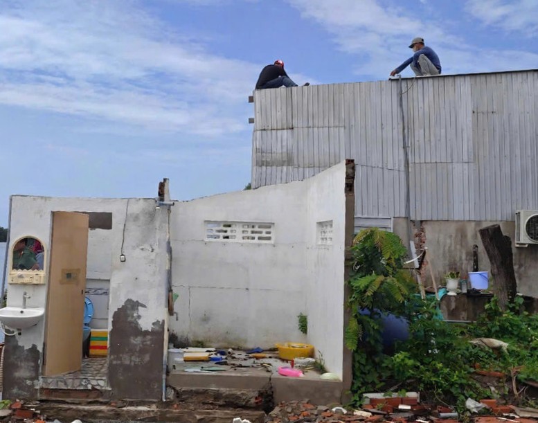
Mr. Nguyen Van Dong in Hamlet 3, Gia Rai Ward, Ca Mau Province - one of 5 households whose houses collapsed in the early morning of July 13 - said: In the middle of the night when everyone in the house was sleeping, he suddenly heard a loud shaking from houses on the riverbank, and just a few minutes later, they collapsed completely into the river".
Mr. Tran Son Dung - resident of Bien Dong A hamlet, Hiep Thanh ward - said: "Previously, when there were no concrete pillars to protect the embankment, in this area, when there were big waves, strong winds hit the dike body, causing rocks and soil to rise to a meter, overflowing the dike body, water flowing into residential areas".
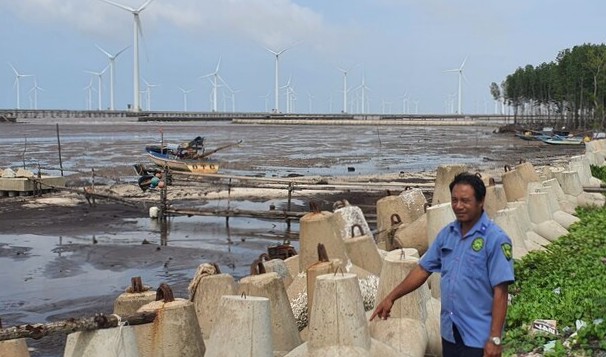
Having a house near the landslide area, Mr. Lam Da Riet shared: When there were no protective embankments, big waves overflowed the embankment, flowing straight into the house, the strong waves made my house shake, not daring to stay in the house. Every time we see big waves, we are afraid, but since the construction of the breakwater, people should be more assured, the big waves no longer hit the dike body hard.
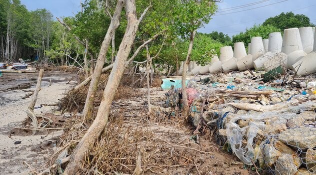
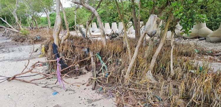
The landslide section in Vinh Trach Dong commune, the old Bac Lieu province (now Hiep Thanh ward, Ca Mau province), bordering the old Soc Trang province (now Can Tho city) was built with an outer breakwater, reinforcing the foot of the embankment by pouring rocks into the houses damaged by waves. However, this dike section is still low, high tides and water still overflows into people's houses.
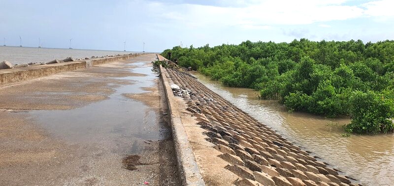
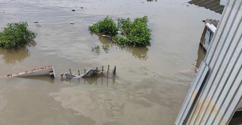
In many East Sea dykes, there are no more forests so the waves hit the foot of the dykes directly. At the same time, when high tides combine strong winds at sea, they are likely to form strong waves that cause sea water to overflow the dykes into the production area and houses inside the fields (there are 60 households from the foot of the dykes to the field 100m and 800 households from the foot of the dykes to the field 2,000m), affecting the lives, production situation, safety of life and property of some households behind the dykes.
From the beginning of 2025 to now, the total damage caused by natural disasters in Ca Mau province has reached over 16.1 billion VND. In which: 10 fishing boats sank, killing 2 people, 4 people missing and 8 people drifting; 11 houses collapsed, 20 houses with roofs blown off, 1 roof covered with gasoline and oil damaged; flooded 1,955 hectares of Summer-Autumn rice, 0.03 hectares of vegetables damaged; 48 landslides along the river with a length of more than 1,200m (including 652m of concrete road), damaged 26 houses, 2 shrimp culverts, 1 shrimp square of the Forest Protection Management Board affected; high tides caused an 18m embankment tank, flooded 546m of rural traffic road...