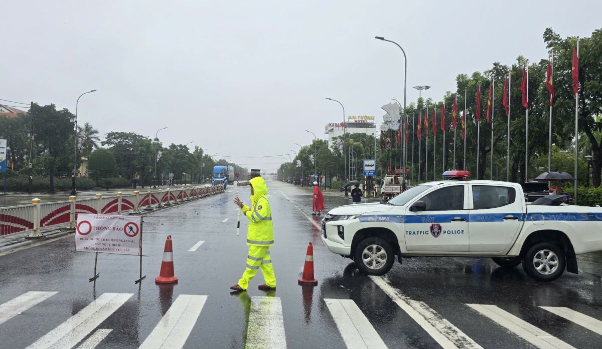
On the afternoon of November 3, prolonged heavy rain caused flooding on many national highways through Hue City and Quang Tri. Some important road sections were cut off, authorities had to be on duty, place warning signs and divert traffic.
According to the Hue City Department of Construction, on National Highway 1, Phong Dien - La Son section, water overflowed the road surface at km806 - km810, flooding from 0.3 to 0.6m deep. The authorities have banned cars with 4 to 7 seats and small trucks from traveling through this area. People are advised to travel along the Hue bypass - National Highway 49B to ensure safety.
On National Highway 49B, from km1+000 to km48+000, water was 0.2 - 0.7m deep, with barriers prohibiting traffic. From km98+000 to km102+ back, rocks and soil spilled onto the road, vehicles had to slow down when traveling.
On National Highway 49, many points have landslides and local traffic jams. Slide locations such as km49+200, km50+500, km50+700, km51+250 (Kim Quy Pass) have been opened to traffic; only km48+700 and km75+070 have only one section temporarily closed. The deeply flooded sections are currently temporarily suspended from circulation, including km1+000 - km14+500 (flooded 0.4 - 0.5m), km20+300 - km21+500 (flooded 0.6 - 1m), km23+810 - km23+850 (flooded 0.4 - 0.6m).
At the Lim 1 bridge area under construction, the road is temporarily flooded, the authorities instructed vehicles to follow the route from Exit 47 of Minh Mang Street to Vo Van Kiet. On the Ho Chi Minh Highway West branch, from km366 to km412+500, traffic was completely blocked. As for the La Son - Tuy Loan Expressway, the Hue - Nam Dong section has been temporarily opened to traffic, while the Southeast - Da Nang direction is still congested.
According to the Quang Tri Provincial Civil Defense Command, heavy rain caused flooding at 139 traffic locations, including 6 points on national highways. National Highway 1A section through Bac Ngu village, Ninh Chau commune (in front of Gia Ninh Primary School) was flooded. National Highway 49C was flooded at km33+600 - km34+080 and km35+200 - km35+450 (Vinh Dinh commune) 15 - 25cm deep, the section km38+650 - km40+150 (My Thuy commune) was flooded 10 - 20cm, causing traffic jams. National Highway 15D Dakrong spillway (km0+307) was flooded 1.1m; La Hot spillway (km1+094) was flooded 0.25m, causing traffic jams; National Highway 9C through Cam Lien was also flooded.
Currently, authorities are arranging barriers, warning signs and being on duty at vulnerable points to ensure traffic, while advising people to limit traveling through areas with deep flooding and risk of landslides.


