Since the last major flood in late September and early October 2025 (influenced by Storm No. 10 Bualoi), the water level of the Thao River (Red River) passing through Lao Cai, Phu Tho and Hanoi provinces has gradually receded, especially in Lao Cai and Phu Tho.
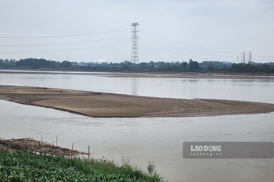
According to records of Lao Dong Newspaper reporters on the morning of January 2, 2026, the water level of the Thao River through Phu Tho province has dropped deeply. It is easy to record countless alluvial grounds and sand dunes rising in the middle of the river, along the river, the flow is narrowed...
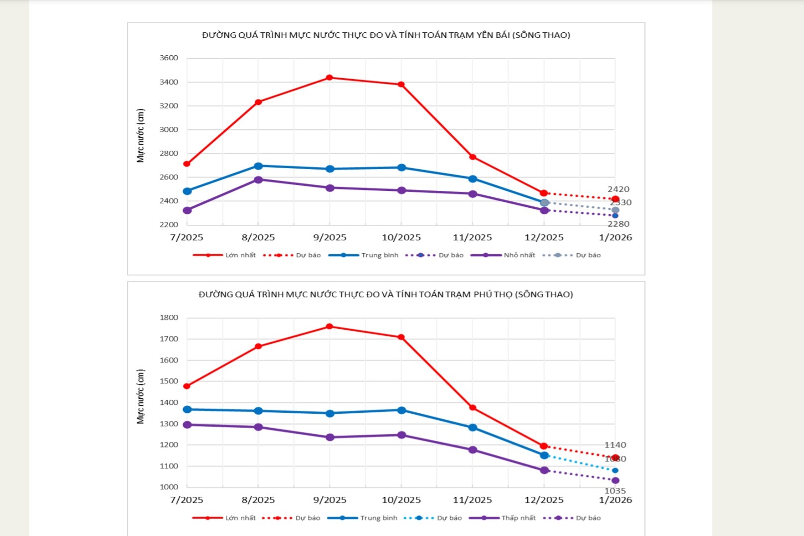
According to the Long-term Hydrometeorological Forecast and Warning Bulletin of the National Center for Hydro-Meteorological Forecasting (forecast for January 2026), in December 2025, the water level of the Thao River section passing through Lao Cai and Phu Tho provinces will change slowly following a downward trend.
The actual water level data table shows that on the Thao River at Yen Bai station (now Lao Cai province) in December, the average is 23.91m, the highest is 24.68m, the lowest is 23.25m.
At Phu Tho station, in December, the average water level of the Thao River was 11.53m, the highest was 11.95m, the lowest was 10.82m.
At the same time, the downstream flow of the Red River at the Hanoi station changed slowly and was affected by tides and the regulation of the upper-level hydropower line.
The water level of the Red River at Hanoi station in December averaged 1.23m, the highest was 2.21m, the lowest was 0.44m.
In January 2026, it is forecast that the water level of the Thao River in Lao Cai and Phu Tho will continue to change slowly; the water level downstream of the Red River at the Hanoi station will change slowly and be affected by tides and regulation of the upper hydropower line. Specifically from January 16 to January 2026 and from January 29 to February 4, 2026, the water level at the Hanoi station will rise due to reservoirs increasing power generation to serve water for rice cultivation in the Winter-Spring 2025 - 2026 crop.
Also according to forecasts, in January 2026, the water level of the Thao River at Yen Bai station will be average at 23.30m, highest at 24.20m (in the first 10 days of mid-month), lowest at 22.80m.
At Phu Tho station, the average water level is forecast to be 10.80m, highest 11.40m (in 10 days of mid-month), lowest 10.35m.
At the Hanoi station, the water level of the Red River in January is forecast to average at 1.10m, highest at 2.30m (during the last 10 days of the month), and lowest at 0.25m.


